

Home > Hemisphere

About the Hemisphere brand
Backed by more than 23 years of industry experience, Hemisphere survey equipment is built on a strong foundation of patented innovations and proprietary intellectual property. Hemisphere GPS is a global company, with sales in over 55 countries, specializing in the marine, mapping and land surveying equipment industries, incorporating both global positioning and navigation. Several advancements in the surveying industry are due to the innovations introduced by Hemisphere. They provide board-level OEM solutions, innovative smart antenna technology, and receiver systems. Hemisphere equipment is capable and versatile. Solutions are cost-effective and easy-to-use with convenient integration into machine control applications or stand-alone functionality.
Hemisphere GNSS stands out for its:
Showing 1–16 of 46 results

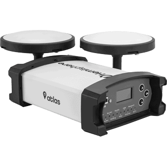


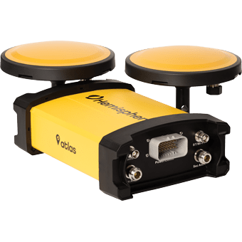


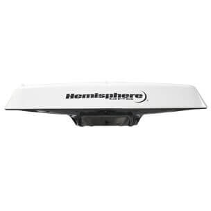


Hemisphere specializes in precision GNSS receivers, smart antennas, and heading systems designed for surveying, marine navigation, construction, and machine control. Their equipment is recognized for reliable multi-constellation tracking, strong correction services, and dependable performance in demanding field environments.
Accuracy depends on the correction method used. Stand-alone GNSS positioning typically delivers meter-level accuracy, while SBAS or L-band correction services improve precision to sub-meter or decimeter levels. RTK-enabled Hemisphere receivers can achieve centimeter-level positioning suitable for professional surveying and construction layout.
Atlas is Hemisphere’s satellite-delivered correction service that provides decimeter-level accuracy without requiring a local RTK base station or cellular connection. It is especially valuable in remote regions, marine environments, and wide-area mapping projects where traditional RTK connectivity is limited.
A GNSS receiver typically connects to an external antenna and field controller, offering flexible configuration for survey workflows. A smart antenna integrates the receiver, antenna, and communications into a single compact unit, simplifying setup for mapping, marine, and RTK survey applications.
Yes. Hemisphere equipment is widely used across marine navigation, hydrographic surveying, agriculture guidance, construction positioning, and traditional land surveying. Product selection depends on required accuracy, heading capability, and correction method.
Many Hemisphere GNSS systems support RTK base-and-rover workflows as well as network RTK correction services delivered via cellular or radio connection. This flexibility allows surveyors to maintain centimeter-level accuracy across a wide range of job site conditions.
Heading receivers use dual-antenna positioning to determine true direction without movement. They are commonly used in marine navigation, machine control, and applications where precise orientation is required even at low speeds or when stationary.
Selection depends on accuracy requirements, environment, correction availability, and workflow integration. RTK receivers are ideal for high-precision surveying, while L-band or SBAS solutions are better suited for wide-area mapping or remote operations. Matching the receiver, antenna type, and correction method ensures reliable field performance.
Yes. Proper setup of corrections, communications, and field software is essential for achieving expected accuracy. Assistance with configuration, integration, and deployment helps ensure the system performs reliably in real survey and marine environments.
We have what you need
Hemisphere GNSS receivers are designed for precision applications where accuracy and reliability are critical. Unlike consumer-grade GPS used for basic navigation, these systems support surveying, construction, agriculture, marine, and machine control workflows where consistent positioning is required.
With over 20 years of development, Hemisphere GNSS technology is widely used across industries that depend on dependable field performance. Solutions such as the Hemisphere S321 remain a popular choice for crews looking for reliable GNSS capability in real-world conditions.
The Bench Mark Advantage
This approach ensures you get both the right equipment and the support needed for consistent performance in the field.
Feature / Criteria | Hemisphere GNSS | Trimble | Leica Geosystems | Topcon |
Performance & Accuracy | High-precision RTK GNSS suitable for professional applications | Industry-leading accuracy | Extremely high precision for specialized work | Strong and reliable accuracy |
Ease of Use | User-friendly systems designed for efficient workflows | Powerful but can be complex | Advanced systems may require training | Generally easy to use |
Technology & Innovation | Patented GNSS technologies and smart antenna solutions | Advanced integrated ecosystem | High-end measurement technology | Strong focus on automation |
Flexibility | Works in standalone systems and machine control applications | Best within Trimble ecosystem | Optimized for Leica workflows | Flexible across applications |
Cost / Value | Cost-effective with strong performance | Premium pricing | Premium pricing | Mid-to-high pricing |
Best For | Professionals seeking reliable GNSS at a strong value | Large enterprise projects | High-precision engineering | Construction and surveying |
Precise GNSS positioning for field applications
Hemisphere GNSS systems are used across a wide range of industries where precision positioning is critical.
Land Surveying
Hemisphere GNSS receivers provide accurate positioning for boundary surveys, topographic mapping, and control work.
Construction & Machine Control
Reliable positioning supports grading, excavation, and machine guidance applications.
Precision Agriculture
Hemisphere GNSS technology enables accurate guidance for planting, spraying, and harvesting operations.
Marine & Hydrographic Applications
GNSS systems provide reliable navigation and positioning for marine and water-based surveys.
GIS & Mapping
Efficient data collection for asset management, environmental monitoring, and mapping projects.


Our satisfaction guarantee
Hemisphere GNSS systems are widely used for precision positioning across surveying, construction, and mapping applications. With a strong focus on application-specific solutions, these systems are designed to deliver consistent accuracy and dependable performance in real field conditions.
We work closely with Hemisphere equipment and help match the right solution to your workflow, ensuring you get the performance you need without unnecessary complexity. Our focus is on helping you maximize field time and maintain reliable operation across your projects.
Training & Support for Hemisphere GNSS Systems
This approach helps ensure your Hemisphere system performs reliably and fits seamlessly into your day-to-day operations.