Home > GEOMAX
GeoMax and Bench Mark
GeoMax is a leading brand in the global construction and surveying markets. Specializing in everything from total stations and GNSS instruments to software, optical and digital levels, and accessories, GeoMax provides high-performing products. Not only do they get the job done, these products are exceptionally easy to use as well as durable and reliable. At Bench Mark, we are excited to make these European-made products more accessible to our clients in western Canada, offering full support and equipment training.
GeoMax stands out for its:
Showing all 7 results
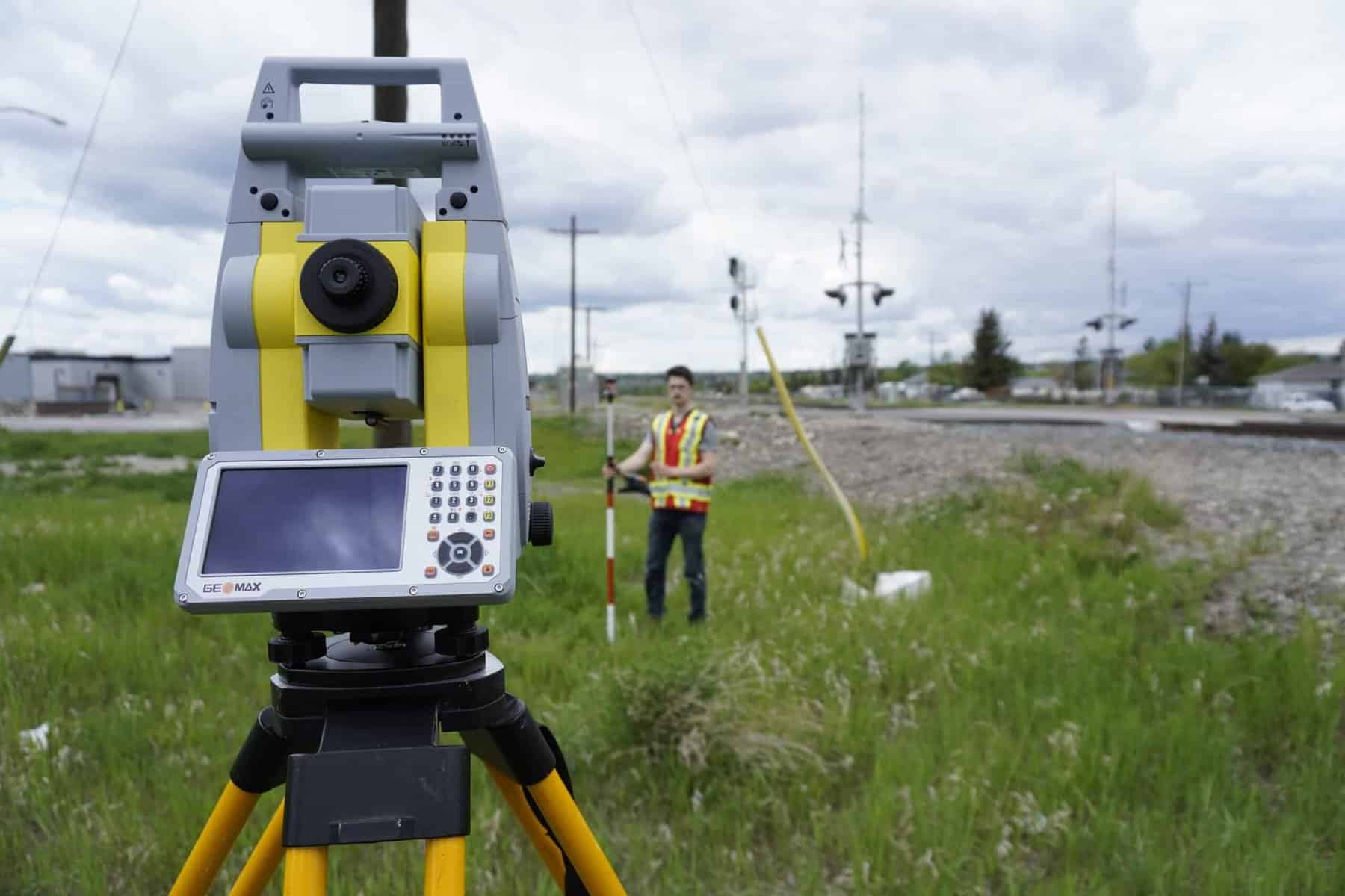
GeoMax offers a complete range of professional surveying solutions, including GNSS receivers, robotic and manual total stations, construction positioning systems, and field software. These tools support workflows in land surveying, construction layout, GIS data capture, and engineering measurement.
Yes. GeoMax is part of the Hexagon group, the same parent organization as Leica Geosystems. GeoMax equipment is designed to deliver reliable performance and modern technology at a more accessible price point for survey and construction professionals.
GeoMax systems are commonly used by land surveyors, construction contractors, engineering firms, and GIS professionals who need dependable accuracy, efficient field workflows, and strong value without the highest premium pricing tier.
Yes. GeoMax GNSS receivers support multi-constellation tracking and RTK positioning, enabling centimeter-level accuracy for surveying, construction staking, and mapping when used with proper correction services.
Robotic total stations improve productivity by allowing one-person operation, automated prism tracking, and efficient layout workflows. This helps reduce field time while maintaining precise angular and distance measurements.
GeoMax instruments are designed to work with dedicated field software such as X-Pad, supporting data collection, layout, and project coordination. Collected data can be transferred to common CAD, BIM, and GIS environments for processing and delivery.
GeoMax is often selected by professionals who want modern surveying capability and dependable accuracy while maintaining tighter equipment budgets. It provides a balance between performance, usability, and overall investment cost.
The best configuration depends on whether your projects focus on GNSS surveying, robotic total station layout, construction positioning, or GIS mapping. Matching the instrument type to your primary workflow ensures the most efficient and cost-effective setup.
Robust and Reliable
At Bench-Mark, we understand that performance in the field matters, that’s why we offer the GeoMax line of instruments. These instruments stand up to the top end competition, without breaking the bank to do so.
Feature / Criteria | GeoMax | Trimble | Leica Geosystems | Topcon |
Performance & Accuracy | High-precision GNSS and total station performance for professional use | Industry-leading accuracy | Extremely high precision for specialized applications | Strong and reliable accuracy |
Ease of Use | User-friendly systems with intuitive workflows and GeoMax X-PAD | Powerful but can be complex | Advanced systems may require training | Generally easy to use |
Product Range | GNSS, total stations, levels, and software | Extensive ecosystem | Broad high-end portfolio | Wide range of solutions |
Technology & Innovation | Modern, efficient systems with strong integration | Advanced innovation and integration | High-end measurement technology | Strong focus on construction tech |
Cost / Value | Excellent price-to-performance ratio | Premium pricing | Premium pricing | Mid-to-high pricing |
Best For | Professionals seeking reliable, cost-effective solutions | Large enterprises requiring full integration | High-precision engineering projects | Construction and surveying professionals |
Integrated surveying solutions for accurate measurement and efficient field operations
GeoMax systems are designed to support a wide range of applications where accuracy and efficiency are critical.
Land Surveying
GeoMax GNSS and total station systems provide accurate positioning for boundary surveys, topographic mapping, and control work.
Construction & Site Layout
From staking points to as-built verification, GeoMax equipment improves productivity on job sites.
Engineering & Infrastructure
Precise measurement tools support infrastructure development and project planning.
Leveling & Elevation Control
Digital and optical levels provide reliable elevation measurements for grading and construction.
General Surveying Applications
Accessories and integrated software solutions support efficient field operations.


Self-Calibrating – No Down Time
GeoMax total stations are designed to keep you working—not waiting. With built-in self-calibration functionality, you can quickly verify and adjust your instrument directly in the field without the need for frequent service visits.
This means no more sending your equipment away for calibration or dealing with unexpected downtime during critical projects.


