
Surveying has come a long way from chains, compasses, and paper field notes. Today’s professionals rely on advanced instruments that deliver centimeter-level accuracy in real time. The right surveying and measuring equipment is critical to success for a land surveyor setting boundary lines, a construction crew laying out subdivisions, or an engineer monitoring environmental change
In this guide, we’ll walk through the essentials every modern surveyor should know.
Why Surveying and Measuring Equipment Matters
Core Categories of Surveying Equipment
Emerging Tools in Surveying
Choosing the Right Equipment
The Canadian Market: What to Know
Best Practices for Professionals Using Surveying Equipment
The Right Tools, The Right Data
FAQs
Surveying involves creating precise, reliable data that projects depend on. The wrong equipment or the wrong setup can introduce misaligned roads, incorrect property boundaries, or delays in construction schedules.
Today, surveyors lean on a combination of tried instruments like total stations and levels, modern GNSS receivers that harness satellites for real-time positioning. These tools are the basis of civil engineering, land development, and infrastructure projects across Canada.
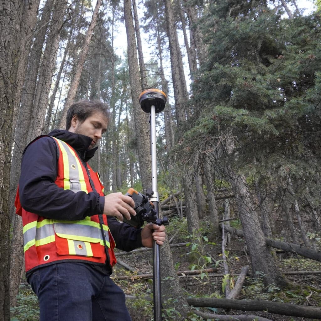
The gold standard for modern fieldwork is GNSS (Global Navigation Satellite System) receivers, often used with RTK (Real-Time Kinematic) corrections. This pairing allows surveyors to collect data with centimeter-level precision in real time. That’s a leap from traditional GPS, which can be off by several meters.
The Hemisphere S631, our flagship GNSS receiver, delivers high accuracy and reliability. It’s trusted by 80% of our new customers and has become a backbone of survey operations across Canada.
For crews on tighter budgets, newer entrants like our GeoMeasure Nano 7 offer affordable RTK performance.
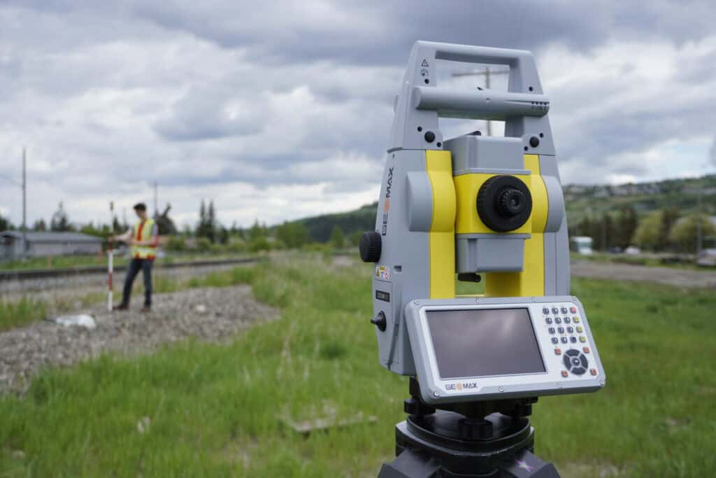
Before GNSS took over, total stations were the workhorse of the industry — and they still have a major role. A total station combines angle measurement (like a theodolite) with electronic distance measurement. The GeoMax Zoom95, a robotic total station, integrates with field software for efficiency.
Simple but essential, levels establish a horizontal plane across a job site. They’re particularly important in construction and engineering applications where elevation and drainage matter.
Theodolites are less common in daily work today, but they still see use where precise angle measurement is necessary. Many total stations are built on theodolite principles, but standalone models remain useful for specialized projects.
Surveyors rely on simple measuring tools:
No piece of hardware can work without good software. FieldGenius, developed by MicroSurvey in Canada, powers much of today’s GNSS and total station workflows. The latest Android version continues to evolve. Many professionals still prefer the legacy package for its reliability and features.
Unmanned aerial systems and 3D laser scanners are increasingly being used for topographic mapping, stockpile measurement, and large-area surveys. They cannot replace traditional instruments, but still bring speed and safety in large or inaccessible areas.

Selecting the right surveying and measuring equipment depends on your industry and project type:
Survey equipment distribution in Canada is unique. Major players like Cansel (Trimble), Brandt (Topcon), and Lewis Instruments (Leica) hold exclusive rights to certain brands and create regional monopolies. However, Bench-Mark operates differently. From a single office, we supply and support customers across Canada and the U.S.. We focus on open, affordable, and flexible solutions.
Surveying and measuring equipment has never been more powerful or more essential. The right tools ensure projects stay on time, on budget, and on target. At Bench-Mark, we believe surveyors across Canada deserve access to equipment that’s accurate, affordable, and supported by real experts. Our team can help you upgrade to RTK GNSS, explore total stations, and outfit a new crew.
Ready to equip your crew with the right surveying and measuring equipment? Explore our full lineup of GNSS systems, total stations, and accessories today.
RTK GNSS receivers provide centimeter-level accuracy, making them the most accurate tools for most field applications.
Yes. Total stations are essential in areas where GNSS signals are blocked or unreliable. Most professionals use both.
Consumer-grade systems can work for hobby projects, but professional surveyors need reliable, supported equipment with proven accuracy, especially for legal or construction work.
We provide cross-Canada support, competitive pricing, and equipment that integrates with multiple platforms.
