
When looking for equipment to measure or find your position, there are lots of different options. Understanding your accuracy needs in relation to the actual instrument specifications is not always easy. In this article, we are going to cover what the different accuracy levels you can expect from GNSS equipment are, and how that can fit into your budget.
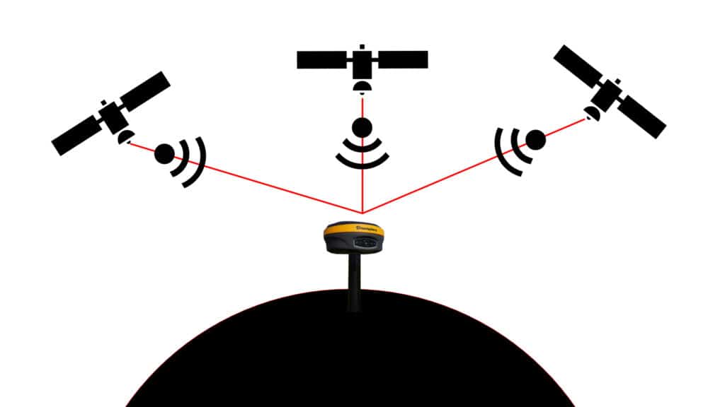
A GNSS receiver works by taking corrections broadcast by GNSS satellites and using the information to determine a position on the globe. There are multiple different satellite constellations including; the American’s GPS, the Russian’s GLONASS, the European Union’s Galileo, the Chinese Beidou, and the Japanese IRNSS.
Although performing similar functions, these constellations do have different advantages and disadvantages, and if you want to read more about those differences check this article out where we compare the Hemisphere S321+ to the Hemisphere S631. The important thing for us is to understand that the satellites are constantly broadcasting information while in orbit. In the vacuum of space, these orbits are very predictable and stable. Your GNSS receiver can receive the satellite broadcasts, and by using multiple satellites, can determine your position via triangulation. This is a vast simplification of what is happening, and if you want to learn more, I suggest checking out NovaTel’s excellent free textbook: An Introduction to GNSS.
There a plethora of different options to meet your positioning needs. In this article we are going to look at 4 different accuracy levels; 1-20 m, 0.5 – 1m, 10 – 50 cm, and 8 – 15 mm, and look at what kind of receivers you need to meet those requirements. Understanding what technology can meet your requirements means you can make the best possible purchasing decision.
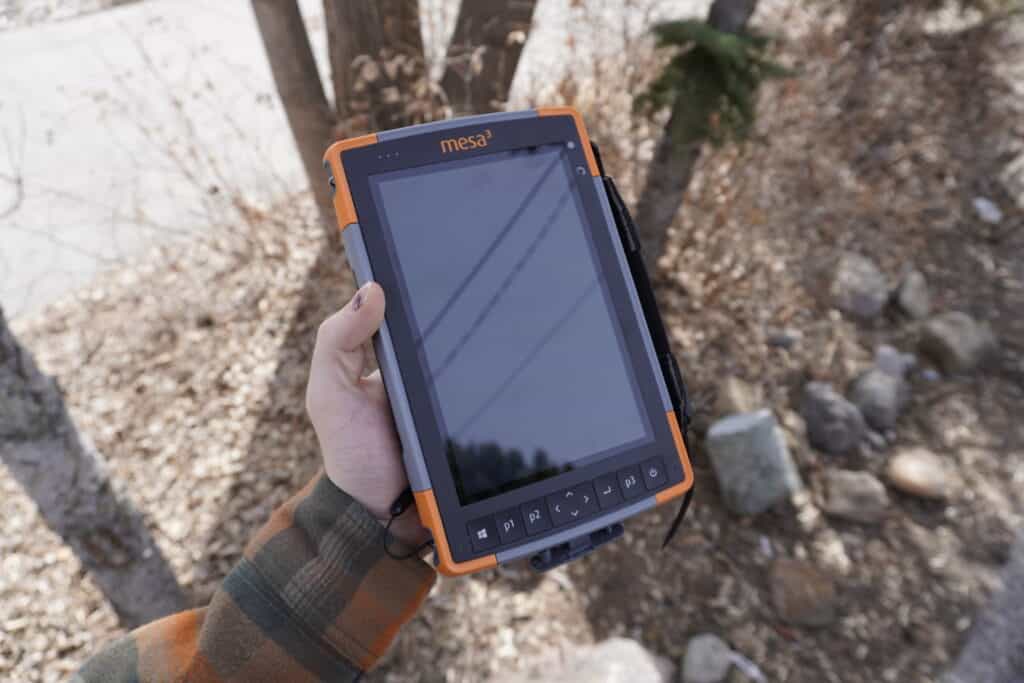
The cheapest and simplest option for GNSS positioning is the GNSS boards found in nearly all modern cell phones, tablets and other electronic devices. These boards and antennas typically provide an accuracy range of 1 – 20 m and are considered a consumer level board. These GNSS boards typically range in price from $1 – $1000. For examples see the Ublox M8030 (the chip found in the Juniper CT8X2 Rugged Android Tablet) or the Ublox NEO-M8 Series (found in the Windows 10 tablet, the Juniper Mesa 3)
This type of GNSS board will not perform particularly well under canopy, near buildings or any adverse conditions. Your accuracy will vary widely, and is highly dependant on conditions and available satellites. Depending on the model you may only be able to use 2-3 constellations at one time, and are limited by the number of individual satellites that can be used in a single solution.
This description may not sound particularly appealing if you are looking for a solution that will allow you to get a precise location. However, these kind of GNSS boards are not built for that application. They are designed for consumer products to provide a base level of positioning while being incredibly compact and energy efficient.
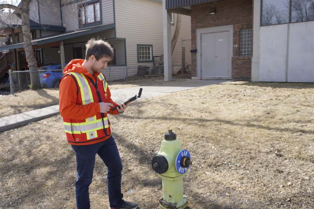
The Sub-Meter GPS accuracy is typically found in devices that bridge the gap between consumer and professional-grade accuracy. These types of receivers will provide a position to within half a meter in open sky. However, much like the above under tree canopy and near buildings the accuracy will decay. This means that if you need that 0.5 – 1 m accuracy near buildings or under trees, you will not be able to obtain that shot.
Most sub-meter solutions are standalone antennas that are either integrated into a tablet or phone, or paired via Bluetooth to the device. They are oftentimes small, compact and have long lasting batteries. This is the perfect solution for quickly recording a position, notes and descriptions while turning on and off the receiver.
Products in this accuracy category include the Juniper Geode or the GeoMeasure A90. A common application for these products is the measurement of utility features. An operator can record the location of, for instance, a power pole and enter relevant descriptions, photos or notes that can be downloaded later at the office.
The next accuracy level for GNSS typically previously existed in a no man’s land, where no solution was the exact right fit. You had either the option of sub-meter GPS accuracy as described above, or the RTK level accuracy. However, over the past decade and a half, solutions like Hemisphere’s Atlas correction service have come on line. Hemisphere’s Atlas correction service works by taking satellite data and processing it at several different ground stations (see this white paper for more information). This allows for several different accuracy levels varying from 10, 30 and 50 cm. This accuracy is all achieved autonomously without the need for a base station or cell infrastructure.
This sounds great on paper, however, there are several downsides to this kind of solution. Although you can achieve this higher degree of accuracy, you are still limited again by canopy and buildings. This brings us to the main limiting factor of these kind of L-band solutions. To achieve this kind of accuracy, these L-band receivers have to take time to converge. This can take up to 30-minutes to occur. You do not have to be stationary while this occurs, but it does have to have a clear view of the sky. Unfortunately, this means that if you have to work in a contested environment and lose lock, you may have to wait 30 minutes before you can begin recording points again at the 10-50 cm level accuracy. Standalone these units can achieve accuracy of 0.5 – 1 m.
Almost all of Hemisphere’s units can receive Atlas corrections including; their Vector antennas, Atlas antennas, and the Hemisphere S631. Antennas like this are great solutions for those looking for a real-time position with a higher degree of accuracy than a stand-alone system.
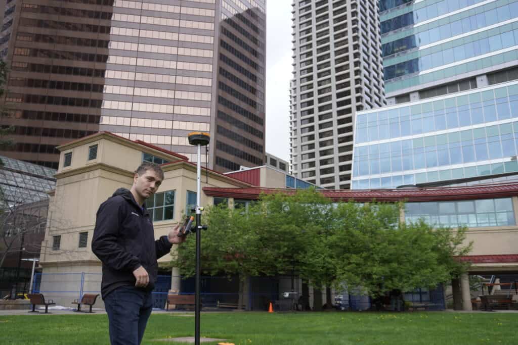
The most accurate solution for GNSS equipment is the sub-centimeter level. This can be achieved using two different methods; Real-time Kinematic (RTK) or static. With RTK as the name suggests you get this accuracy in real-time. Depending on the receiver, you can also get this accuracy near buildings and under canopy. See this video for a comparison of 6th and 7th generation RTK technology. The other option is to perform a static measurement. With a static measurement you record GNSS measurements over the course of several hours. You can check out this on Static Recording to get an idea of how long you should record for.
These types of products allow for real-time measurements of sub-centimeter accuracy with a high degree of repeatability, check out this video for a demonstration on what kind of repeatability you can expect. Typical use cases include professional land surveys and the establishment of ground control for drone surveys.
To achieve this level off accuracy you need to an RTK receiver. Options include the Hemisphere S631, where you can run it either as a network rover, a base station or as a static receiver. These type of systems do take a bit of learning to get the most out of, which is why we offer training, support and an extensive cheat sheet and video library.
Sub-meter receivers are suitable when centimeter precision isn’t required, and environmental conditions allow for open-sky operation. Typical situations where sub-meter GPS accuracy is fully sufficient include:
In these settings, sub-meter positioning allows crews to collect meaningful spatial data quickly without the cost or complexity of RTK.
Choosing sub-meter technology makes sense if your workflows focus on asset location, inspection, or mapping rather than boundary establishment or engineering layout. If your work involves frequent movement between sites, limited time on each point, and cost-control considerations, sub-meter GPS can offer a great alternative to RTK.
Sub-meter systems also integrate well with handheld tablets and lightweight antennas, so they are accessible for new users or teams transitioning from consumer-grade devices.
If your workflow values flexibility, lower equipment cost, and field efficiency over centimeter-level precision, sub-meter GPS is often the right choice. It delivers accurate-enough positioning for GIS tasks without requiring the training, infrastructure, or investment associated with survey-grade RTK systems.
Bench Mark Equipment & Supplies is your team to trust with all your surveying equipment. We have been providing high-quality surveying equipment to land surveyors, engineers, construction, airborne and resource professionals since 2002. This helps establish ourselves as the go-to team in Calgary, Canada, and the USA. Plus, we provide a wide selection of equipment, including global navigation satellite systems, RTK GPS equipment, GNSS receivers, and more. We strive to provide the highest level of customer care and service for everyone. To speak to one of our team today, call us at 403-286-0333 or email us at [email protected]
