Sub Meter GPS

Home > Sub Meter GPS

Surveyor using sub meter GPS receiver for field data collection

Sub Meter GPS Systems

Why buy from Bench Mark?

Explore our selection of sub meter GPS systems designed for professionals who require reliable positioning accuracy for mapping, GIS, and field data collection. Sub meter GPS technology delivers consistent horizontal accuracy within one meter, making it ideal for asset mapping, environmental surveys, infrastructure planning, and utility work. These systems are built for dependable performance in challenging outdoor environments, helping teams capture accurate location data with confidence.


Whether you are mapping utilities, collecting field observations, or performing site verification, sub meter GPS receivers provide a practical balance between precision, affordability, and ease of use. Our collection includes rugged solutions engineered to simplify workflows, improve data quality, and support a wide range of professional applications.

FAQs

A sub meter GPS system is a positioning receiver that provides horizontal accuracy within one meter. It is commonly used for GIS mapping, asset management, environmental monitoring, and general field data collection where high precision is needed without the complexity of full RTK systems.

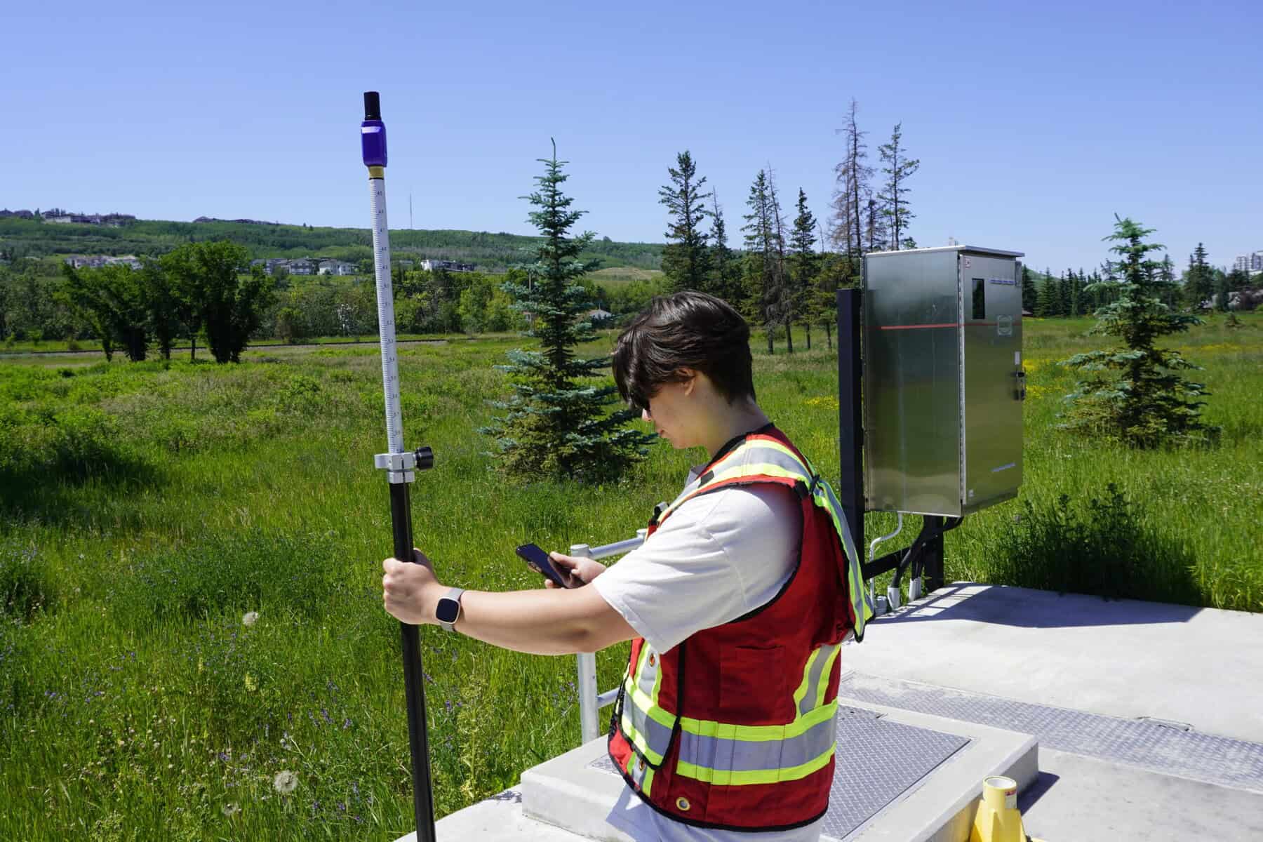
Sub meter GPS is widely used for utility mapping, environmental surveys, land management, infrastructure documentation, construction layout support, and municipal data collection. It is ideal for projects that require dependable location accuracy without centimeter-level precision.

A sub meter GPS receiver typically delivers accuracy better than one meter under good satellite conditions. With correction services enabled, many systems can achieve consistent performance suitable for professional mapping and field verification tasks.

Yes. Sub meter GPS systems are widely used in GIS workflows for collecting spatial data, updating asset databases, and supporting mapping projects that require consistent and repeatable accuracy in the field.

Many sub meter GPS receivers use satellite-based or network correction services to improve accuracy and reliability. These corrections help maintain consistent performance in a wide range of environments.

Yes. Sub meter GPS systems are designed to perform reliably in challenging conditions such as light canopy cover and urban environments, although satellite visibility will always influence final accuracy.

Most sub meter GPS systems feature intuitive interfaces, simple setup processes, and compatibility with common data collection software, making them accessible for both new and experienced users.

Professional Sub Meter GPS Equipment for Surveyors

Everything you need to know

At Bench Mark, we offer professional sub meter GPS equipment that supports efficient field workflows and dependable positioning performance. These systems are designed for operators who need consistent accuracy for mapping, verification, and spatial data collection without the complexity of full RTK solutions. Their rugged construction and reliable signal tracking make them well suited for daily field operations.

Sub meter GPS receivers help surveyors and field crews work faster, reduce re-measurements, and maintain data quality across a wide variety of environments. Whether you are handling asset inventories, boundary verification support, or GIS data capture, this level of GPS accuracy delivers dependable results that support confident decision-making.

Sub meter GPS receiver mounted on survey pole for engineering surveys

Sub Meter GPS Equipment for Engineers

Additional products

Engineers rely on sub meter GPS systems for accurate positioning during planning, documentation, and field validation tasks. These systems support infrastructure development, environmental engineering, and utility network verification by providing dependable spatial data for analysis and reporting.

Our sub meter GPS lineup includes receivers and field-ready solutions built for accuracy, durability, and ease of integration with modern data collection platforms. These systems are engineered for stable operation in demanding site conditions, ensuring reliable positioning throughout long workdays.

At Bench Mark, we understand the importance of dependable positioning technology in engineering projects. Our commitment to expert guidance, professional-grade equipment, and long-term technical support ensures you can confidently select the right sub meter GPS solution for your operational needs.