Alpha3D Unveiling
CHC Navigation offers to geospatial professionals our premium high-performance, vehicle-independent mobile mapping solution to capture mass data in continuously changing world environments on dynamics, enabling them to get work done quickly and more accurately to increase their ROI. The Alpha3D is the ultimate car mounted scanner.


Product details
Package includes
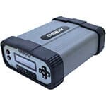
Alpha 3D
CHC Navigation offers to geospatial professionals our premium high-performance, vehicle-independent mobile mapping solution to capture mass data in continuously changing world environments on dynamics, enabling them to get work done quickly and more accurately to increase their ROI.
The Alpha3D combines state-of-the-art high-performance hardware, such as long range, ultra-high speed, precise laser scanner, high-resolution HDR panoramic camera in combination with advanced GNSS receiver and high precision IMU, in one instrument with light weight and compact but in same time rugged design. All these features keep Alpha3D as one of the most innovative systems in the market today.
With Alpha3D users can collect more data faster and reducing time in the field more than 40% compared to traditional surveying instruments. By combination of point clouds and high-resolution images as well as information from additional sensors there is no need to return to site for remeasurement. With multiple type of data measurement professionals can open new industries and applications.
Whatever the task is, the Alpha3D is easily mounted on a variety of platforms, including different type of vehicles, trains, railway trolleys and boats, rapidly and efficiently collects the high density, accurate point clouds and powerful images data but also adds extra information from additional sensors, such as high resolution camera, thermal camera, GPR, echo sounder or extra profiler.
Key Features
High performance laser scanner
• Long range scanning up to 420m
• Extremely high-speed scanning of 1M points per second
• High point cloud density even on high speed driving
• High quality of point cloud with low range noise
High resolution 360° image
• 30 MP HDR panoramic camera with superb image quality
• Fully calibrated point clouds and panorama images
• You can add additional imagery sensors to get extra information
for application needs
Ready now, thinking about future
• Two RS232 ports for external device connection
• Ready to add 2nd scanner for more density of point cloud
• 2nd GNSS antenna to work on railway or water applications
• Easy-In easy-out SSD hard disc for raster data transfer
Capture and control data easily with CoCapture
• Manage the mission and automatically capture data
• BYOD, device free, any browser based operation
• WiFi or LAN cable connection
• Very simple and intuitive, user-friendly design
CoProcess software to manage scanning projects
• Intuitive user interface with rich functionality
• Semi-automated feature extractions
• Powerful engine can support massive data processing
• Easily export extracted information into CAD or GIS deliverables with our SW plugins

Navigating the learning curve independently can be daunting, which is why we offer a solution to simplify your journey. Our program features twice-weekly training sessions designed to accommodate your schedule, making it ideal for onboarding new team members or resolving specific queries through live demonstrations on Zoom.
View Info
Learning a new software package can be daunting, but we have got you covered. That is why we created the Bench-Mark Survey Academy, where you can learn at your own pace. With over 15 hours of content in our library, you can access it on your own time and conquer new skills with ease. But don’t let that overwhelm you, it takes only 20 minutes to get up and running.
View Info


Reviews
There are no reviews yet.