

Every time a Canadian land surveyor drives a stake into frozen ground or a civil engineer signs off on a subdivision boundary, there’s an invisible infrastructure overhead making that precision possible. We’re talking about a web of satellites orbiting 20,000 kilometres above Earth, operated by four different governments, transmitting signals in frequencies you can’t hear or see, and yet precise enough to tell you where you are to within a few centimetres. That infrastructure is GNSS, and understanding how it actually works changes how you think about every coordinate you collect.
What GNSS Means and Why It’s Not Just GPS
How a GNSS Receiver Calculates Position
Where GNSS Technology Meets Survey-Grade Accuracy
What Affects GNSS Performance in the Field
GNSS in Surveying Practice: What a Modern Setup Looks Like
Precision That Starts Overhead and Lands on Your Rod
GNSS stands for Global Navigation Satellite System. It’s the umbrella term for all satellite-based positioning constellations operating today. GPS, the American system managed by the U.S. Space Force, is a single constellation under that umbrella. The full picture includes:
When a professional-grade GNSS receiver tracks all four constellations simultaneously, it has access to 30 to 40 or more satellites at any given time. That depth of coverage is what separates survey-grade GNSS technology from the chip in your phone, not just the hardware, but the number of signals being processed and corrected at once.
For Canadian surveyors specifically, GLONASS matters more than many realize. Its orbital geometry is optimized for higher latitudes, which means stronger satellite availability in northern provinces and territories where GPS geometry alone can be marginal.
The fundamental process is elegant. Each satellite continuously broadcasts a signal that carries two pieces of information: its exact orbital position and a precise timestamp. Your receiver picks up that signal, compares when it was sent to when it arrived, and calculates the distance to that satellite. Because GNSS signals travel at the speed of light, even microseconds of timing error translate into hundreds of metres of positioning error, which is why atomic clocks on board each satellite are central to the entire system.
To determine a three-dimensional position, latitude, longitude, and elevation, a receiver needs signals from at least four satellites. Three satellites narrow your position to two possible points in space; the fourth resolves which one is correct and compensates for the receiver’s own clock imperfections. This process is called trilateration.
The catch is that by the time a signal reaches your receiver, it has passed through the ionosphere and troposphere, bounced off nearby surfaces, and accumulated errors from satellite clock drift. Standard GNSS positioning, the kind your phone uses, handles these errors imperfectly, landing you within a few metres of your actual location.
The gap between “a few metres” and “a few centimetres” is bridged by correction techniques layered on top of standard GNSS. The two most relevant in professional surveying are RTK and PPK.
RTK (Real-Time Kinematic) uses a fixed reference station, either one you set up yourself or a network station accessed over cellular, to broadcast real-time error corrections to your rover. Because the base station knows its precise position, it can measure the errors it observes in the satellite signals and send those corrections to your rover as you work. The rover applies them instantly, resolving position to the centimetre level without any post-processing. Most Canadian survey workflows today run on RTK, often connecting to provincial CORS networks via NTRIP protocol rather than managing a dedicated base.
PPK (Post-Processed Kinematic) records raw satellite observations at both base and rover, then processes them together after the fact. It’s slower to produce results but valuable where real-time correction links aren’t reliable.
Understanding GNSS meaning at a technical level is one thing. Understanding what degrades it in real Canadian field conditions is where surveyors earn their results. The main factors to watch:
A complete GNSS surveying system combines several components working together. The receiver processes raw satellite signals across multiple constellations and frequencies. The antenna, often integrated into the receiver housing on modern units, captures those signals and determines how cleanly they’re received. The data collector runs field software like FieldGenius, managing the correction link, logging coordinates, and guiding the crew through stakeout or collection routines.
Multi-frequency receivers, those that track L1, L2, and L5 signals, resolve integer ambiguity (the “fix” status) faster and more reliably than single-frequency units, especially under canopy or in challenging environments. For professional survey use across Canada’s varied terrain and climate, multi-frequency, multi-constellation capability is the baseline.
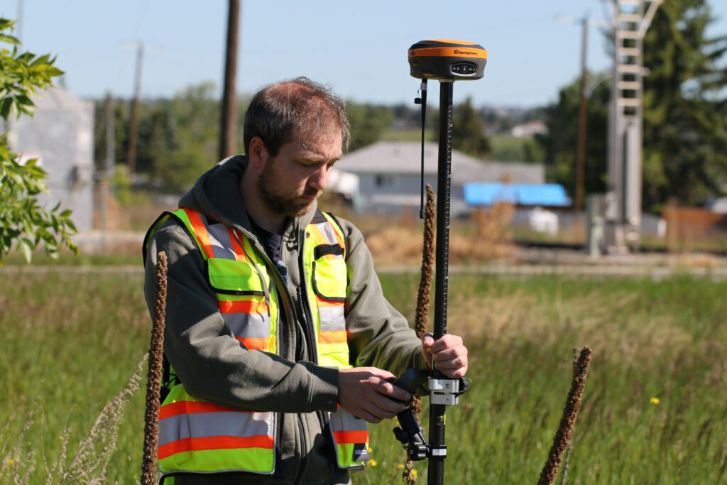
The Hemisphere S631, for instance, is built specifically for this kind of demanding field use: full multi-constellation tracking, integrated tilt compensation, and the rugged construction required for work from the Prairies to the Shield in conditions that range from summer heat to winter cold.
GNSS technology has fundamentally changed what’s possible in Canadian surveying, collapsing workflows that once took days into hours, enabling crews to work independently of benchmarks, and delivering coordinate accuracy that holds up to legal and engineering scrutiny. But the system is only as good as how well you understand it. Knowing which constellations matter at your latitude, how your correction source affects your baseline, and what your receiver is actually doing when it achieves fix, that knowledge is what separates a crew that consistently produces clean data from one that’s constantly troubleshooting in the field.
At Bench-Mark, we support Canadian surveyors and engineers with GNSS equipment built for professional use and a team that understands what the work actually demands. We’re here to make sure your equipment matches your workflow.
