Topographic surveys are essential for mapping elevations, assessing drainage, and planning construction projects. Traditionally, these surveys required tedious manual measurements, but with the widespread adoption of 7th generation RTK (Real-Time Kinematic) technology, the process has become faster and more accurate than ever. If you’re still using conventional methods, like total stations, it’s time to consider why RTK is one of the best options available for performing topographic surveys.
Understanding RTK: A Beginner’s Guide
Components of an RTK System for Topographic Surveys
Advantages of RTK for Topographic Surveys
Auto Recording for Seamless Data Collection
Using a Tilt Sensor to Improve Accuracy
Mapping Contours and Generating Terrain Models
Why RTK is the Best Option for Topographic Surveys
Before diving into the benefits of RTK for topographic surveys, let’s take a moment to understand what RTK is and how it works.
RTK, or Real-Time Kinematic positioning, is a GPS correction technology that provides centimeter-level accuracy by using a base station and a rover. The base station remains in a fixed location and sends correction signals to the rover, which is the moving receiver used for surveying. This correction process eliminates the small errors found in traditional GPS signals, resulting in highly precise positioning. We have an article going in depth on how RTK works, you can check it out here: Introduction to RTK GPS In Land Surveying.

To perform an RTK survey, you need three key components:
1. RTK Base Station – This is a fixed GPS receiver that collects satellite signals and calculates corrections. These corrections are then transmitted to the rover in real-time. They can either be a local base station or an NTRIP network like StormCaster, Cannet, Smartnet, or Topnet.
2. RTK Rover – The mobile receiver that collects GPS signals and applies the corrections from the base station. The rover records data points with high accuracy as you move through the survey area. Corrections are received from a base station over cellular networks or from UHF radios.
3. Data Collector – A handheld tablet or phone style computer with a data collection software onboard. This allows you to perform calculations in the field, add additional information relevant to the points, and even do real time contour lines. Examples include the Juniper Mesa 4 running FieldGenius, the GeoMeasure BMT8 running FieldGenius Android and Trimble’s TSC7 and Trimble Access.
Because RTK provides real-time corrections, it eliminates the need for post-processing, allowing surveyors to get instant, highly accurate results.
Speeding Up Your Survey with RTK
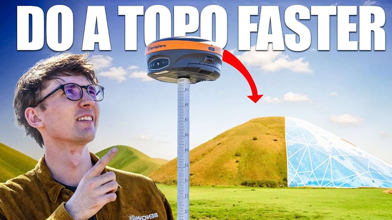
One of the biggest advantages of using RTK is speed. A conventional total station topographic survey requires line of sigh to every point, and if not using a robotic total station, you require a minimum a crew of two. With RTK, you only need one operator and no line of sight. As long you are able to receive corrections from your base you can store a point. We tested the Hemisphere S631 out to 10 km using the internal radios:
Additionally, by setting your tolerances up correctly with the below features, you can speed yourself up further.
– Auto Store Accepted Positions – The software automatically logs a point once it meets accuracy requirements.
– Skipping the Measure Screen – Eliminates the need for additional inputs, reducing downtime between points.
These features mean you don’t have to constantly interact with the data collector. Just walk (or drive) through the survey area, and the RTK system will handle the rest.
Another reason RTK is the best option is its auto-recording feature. Instead of pressing a button to log each point manually, you can set the system to record based on either time intervals or distance intervals. For example, setting the interval to 0.5 meters ensures that points are recorded every half-meter automatically.
This is particularly useful in:
– Large areas – Cover more ground without stopping.
– Rough terrain – Avoid unnecessary delays by letting the software collect points as you move, and not have to worry about whether you still have line of sight to your starting point.
– Cold weather conditions – Keep gloves on and focus on the survey instead of pressing buttons.
By simply setting your parameters and hitting start, you can gather detailed topographic data while walking, driving, or even riding a quad.
One of the most frustrating aspects of traditional surveying is keeping the rod level. With RTK systems like the Hemisphere S631, that’s no longer a concern. The built-in tilt sensor ensures that your measurements remain accurate, even if the pole isn’t perfectly vertical.
This feature allows you to:
– Work on uneven ground without adjusting the rod manually.
– Collect data while driving without worrying about pole orientation.
– Maintain accuracy in challenging environments, such as dense vegetation or rocky terrain.
With tilt compensation, the receiver calculates precise coordinates regardless of tilt, ensuring a smooth and reliable survey. You can learn more about how you can use the tilt sensor with the GeoMeasure Nano 7 to automate building swales:
Once the survey is complete, RTK makes it easy to visualize your data. Importing the recorded points into software like FieldGenius or CAD programs like MSCAD allows you to generate contour maps, slope analysis, and 3D models.
With just a few clicks, you can:
– Identify drainage patterns – Understand how water flows across the landscape.
– Plan earthmoving operations – Determine how much material needs to be moved. You can do this by performing volume calculations in the field!
– Design roadways and infrastructure – Ensure proper grading and alignment.
The ability to collect, visualize, and analyze data quickly makes RTK an indispensable tool for surveyors and engineers alike.
If you’re looking for speed, accuracy, and efficiency, RTK technology is the way to go. With features like:
– Auto-recording for continuous data collection
– Optimized tolerances to minimize delays
– Tilt sensors to maintain accuracy in any environment
– Seamless integration with design software
RTK-based topographic surveys provide a streamlined solution that traditional methods simply can’t match. Whether you’re working on land development, road design, or drainage analysis, RTK ensures you get high-quality data with minimal effort.
So, if you haven’t made the switch yet, now’s the time. Upgrade your surveying process and start collecting data faster, easier, and more accurately than ever before. With RTK, you’ll eliminate tedious manual work, improve efficiency, and ensure high-quality survey results. Whether you’re mapping terrain, planning infrastructure, or analyzing drainage, RTK is the best tool for the job.
RTK (Real-Time Kinematic) GPS is a positioning technology that provides centimeter-level accuracy by using a base station and a rover. It eliminates the small errors found in traditional GPS signals, making topographic surveys faster and more precise.
You need three key components: an RTK base station (for corrections), an RTK rover (to collect data), and a data collector (to process and store survey information). These tools work together to provide real-time, high-accuracy results.
RTK eliminates the need for line-of-sight measurements and can be operated by a single person, whereas total stations often require two operators and a direct line of sight to each point. RTK surveys are significantly faster and more efficient.
RTK systems offer auto-recording, tilt compensation, and optimized tolerances, allowing surveyors to collect data without stopping to press buttons or manually level the pole. These features can increase survey speed by up to 50%.
Yes, RTK survey data can be imported into software like FieldGenius or CAD programs to generate contour maps, slope analysis, and 3D terrain models, making it a powerful tool for land development and engineering projects.
Bench Mark Equipment & Supplies is your team to trust with all your surveying equipment. We have been providing high-quality surveying equipment to land surveyors, engineers, construction, airborne and resource professionals since 2002. This helps establish ourselves as the go-to team in Calgary, Canada, and the USA. Plus, we provide a wide selection of equipment, including global navigation satellite systems, RTK GPS equipment, GNSS receivers, and more. We strive to provide the highest level of customer care and service for everyone. To speak to one of our team today, call us at 403-286-0333 or email us at [email protected].
