


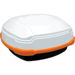
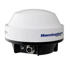
The Hemisphere S631
The Hemisphere S631 is the latest survey receiver from Hemisphere, and boasts all of the latest RTK technology they have to offer. It is a multi-frequency, multi-GNSS reciever that is the best performing receiver to date.
The Hemisphere S631 can receive corrections from all of the major constellations including; Galileo, BeiDou, GPS and Glonass. With the ability to fix off any constellation the S631 can take the best available corrections to determine its position.
GPS: L1CA/L1P/L1C/L2P/L2C/L5
GLONASS: G1/G2/G3, P1/P2
BeiDou: B1i/B2i/B3i/B1OC/B2A/B2B/ACEBOC
Galileo: E1BC/E5a/E5b/E6BC/ATLBOC
IRNSS: L5
QZSS: L1CA/L2C/L5/L1C/LEX
SBAS and Atlas


Cam Christianson –
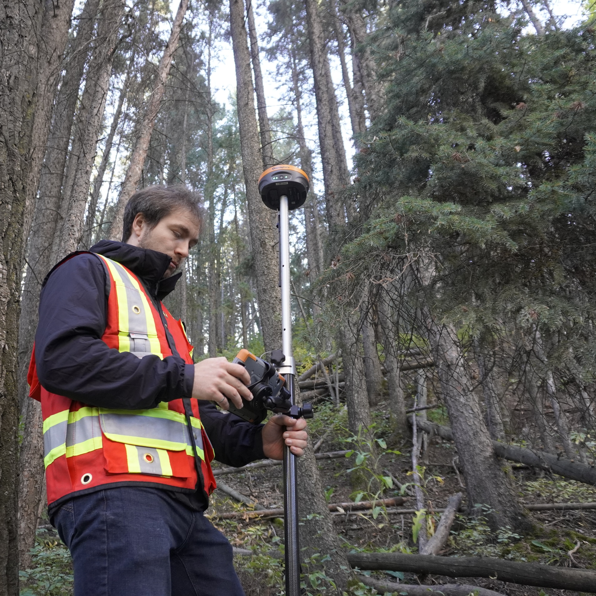
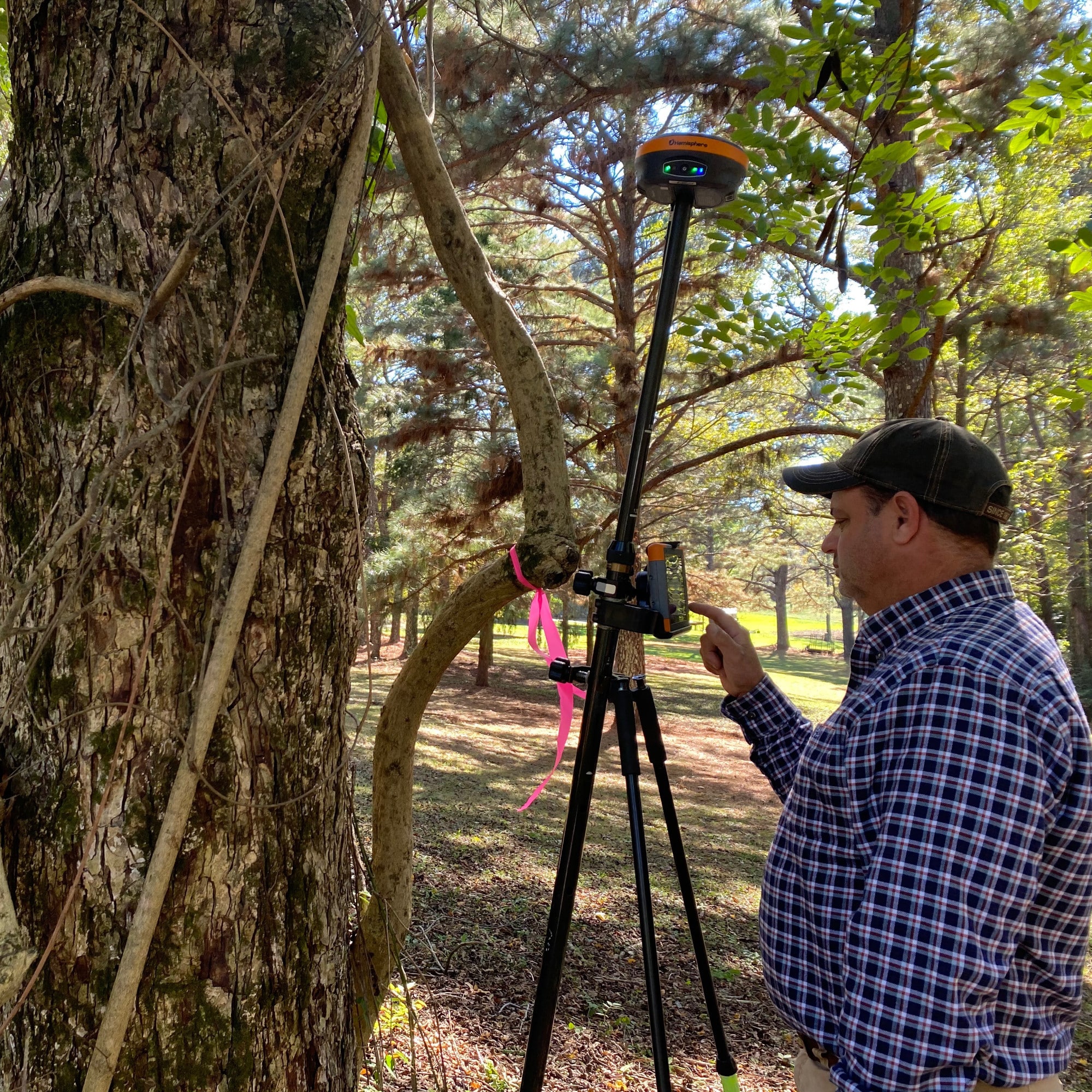
The S631 really feels like an upgrade over the last generation. It feels better built, and the in-foliage and tilt performance is really convenient.
Reid Ostenberg –
The radio range of the S631 has been blowng me away. I haven’t even had to use my external radio. When paired with FieldGeniu, I get an easy-to-use solution that has all of the tools I need.
Allan Andres –
The tilt feature is wonderful, and the S631 works so well under canopy! I was a bit worried about moving to FieldGenius, but it is easy to use once I had it figured out.
Sid Sandback –
We love the tilt capacity on the S631, and we cannot say enough about the Bench-Mark support. We also love the Graphical Layout in FieldGenius, it’s so easy to use.
Tom Mehdi –
The S631 has been great, with tilt we are a lot faster, and the in-canopy performance is making a big difference. Once I got used to FieldGenius, i found it to be way faster.
Shamus McGee –
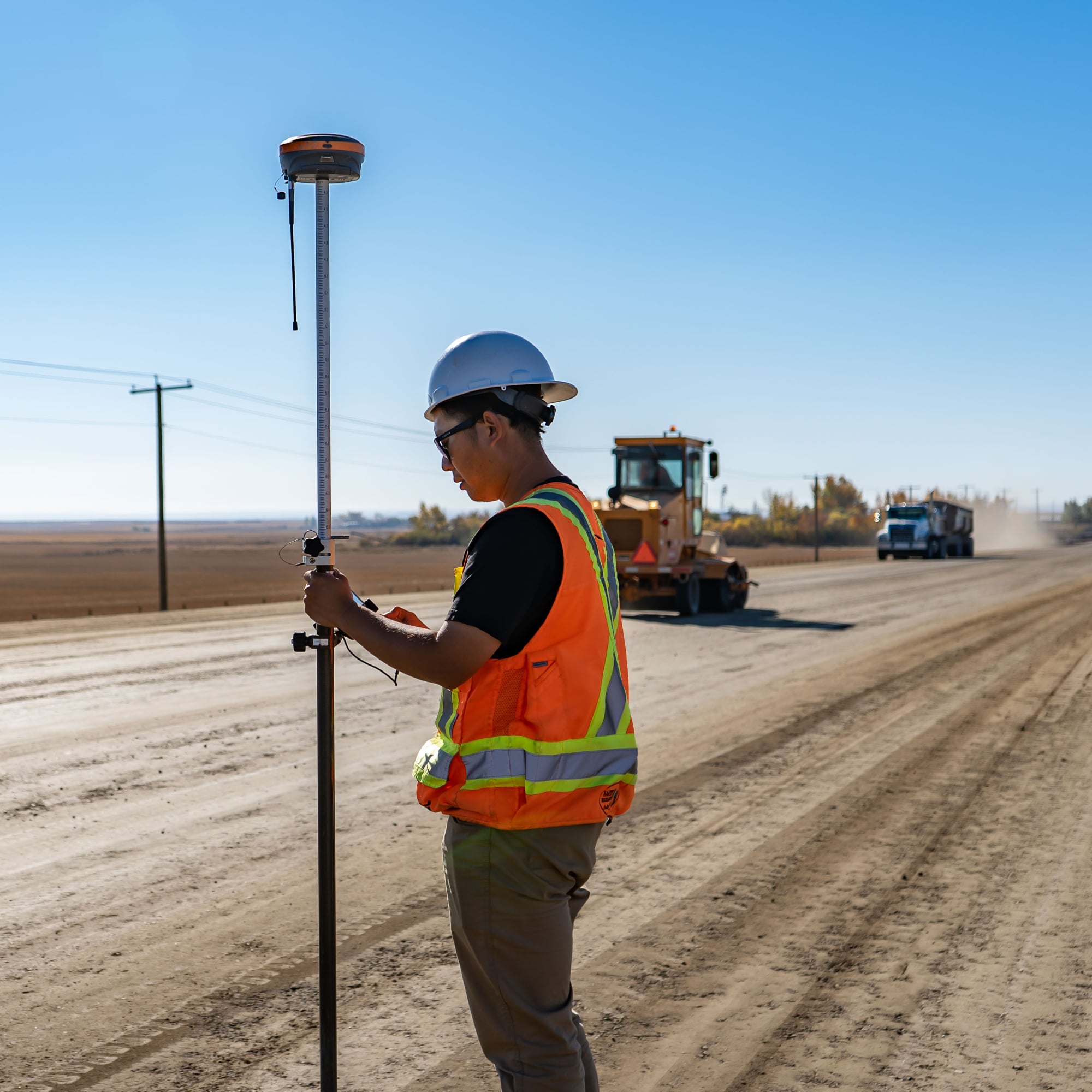
We love the fact that the S631 has a 10 km base-to-rover range, and that they will fix any constellation. FieldGenius has to been the easiest and most user-friendly surveying software we have ever used.
Rudi van der Merwe –
The S631 gives us consistent and accurate results in mountainous and foiliage-covered terrain. We found that FieldGenius was easy to learn and we keep discovering more powerful features.
Connor Traves –
The RTK-fixed coverage with the S631 has been vastly improved over the older S321. FieldGenius has freed up our drafters, and made construction layout a breeze.
Dustin Hicke –
The field crews appreciate how light it is compared to the other models. In addition, the tilt sensor is a great featureto help speed up our fieldwork.
Greg Skelhorn –
The S631 is proving itself to be reliable and fast in all conditions. We have seen a definite performance boost with the addition of the S631.
Ed –
I have been really impressed with the S631 base and Rover system, particularly given its price point compared to “bigger” name brands. However, what I have found most impressive is the customer service provided by Benchmark. I have worked with many dealers and manufacturers over the years who are often happy to dump you once they have made their sale. It is no exaggeration to say Benchmark are SECOND TO NONE. They answer questions promptly and are always there to help problem solve. If you need survey gear, use these guys.
Anthony McRae –
I recently purchased the Hemisphere S631 base and rover along with the Mesa3 tablet with Field Genius. The product is just as good, or better, as I hoped it would be. I have ran a Carlson BR x7 for several years and the Hemisphere is as good, or better, than those units and at a much more affordable price. The guys and gals at BenchMark have been great to deal with and I have no complaints. Their online training has been great help and the couple of times I’ve called with questions, they have been spot on. If you’re in the market for some surveying equipment, I would highly recommend giving them a call.
Lewis Cox –
I’m doing the work of 3 crews using your S631s, so additional units won’t be needed!
I would have never dreamed that these units would be this strong I get shots under canopy that should never happen. I realize I’m now using 4 sat systems rather than 2, but there must be some real high powered electronics inside these units that can discern extreme multipathing and compute out the garbage, it’s quite incredible.
I just finished a 130 acre survey by myself (I’m a one-man show) and never touched my robot. As a matter of fact, I’ve only touched my robot twice this year since getting these S631s back in January, and that was to do a small topo and to stake out a house. These units have performed far beyond my expectations!!! These units have been life changing!!
Thanks so much for everything you, Nolan and David have done for me, you guys rock!!!
Maura McKeough –
Our experience purchasing an RTK system from Bench Mark was outstanding. The staff demonstrated impressive knowledge, investing time to understand and meet our specific requirements. Their assistance was not only helpful but also delivered with a friendly manner. The responsiveness to emails showcased their commitment to customer satisfaction. What truly exceeded expectations was the swift delivery – within a week of the order. Bench Mark’s expertise, excellent service, and efficiency make them a top choice. I highly recommend their RTK systems for anyone seeking a seamless and customer-centric experience.
Joe Manning –
Great service and prompt delivery.
Arlene Lahti –
The sales team were helpful and once the order was placed, the equipment arrived quickly!
Vince Boothe –
We recently bought an S631 system after being with Topcon for 10 years. Bench Mark has been great to deal with. The GNSS receivers are a big step up in terms of performance. Even better though is the technical support. They have a lot of PDF and video training resources available. Any questions we have had get answered quickly by email. I have also called the help number and had someone answer my questions right away.
Andrew Wilkinson –
These guys are amazing!…the Hemisphere solution they offer is a game changer, the only thing thats better is the remarkable service and support and very clear and helpful training videos…buy with confidence you won’t be dispaointed!
Mark LaFresne –
The communication and smooth transaction was the excellent. They take pride in their work and stand 100% behind the product and customers. Purchased S631 RTK kit and looking forward to keeping this relationship on-going.
Charles S –
We love the Hemisphere s631 RTK GNSS with Field Genius software, thanks Bench Mark for the GREAT price and all the help.
Garrett Bullee –
We love the Hemisphere s631 RTK, works great under tree canopy, and we totally prefer Fieldgenius over SurvCE. Thanks so much for all the help.
David Renauld –
Excellent customer service to begin using new Hemisphere S631 equipment and MicroSurvey FieldGenius software. Very knowledgeable of the product and the survey capabilities. Helped me to really understand the new equipment and options is gives me as a surveyor.
Wes Bertoldi –
I purchased my Hemisphere S631 base/rover at the end of 2020. It has been a huge asset to my productivity. The team at Bench mark have been very helpful. If I ever have a question, Rene or David have always been very quick with a solution. I wouldn’t hesitate recommending Bench Mark.
Richard Reece –
Purchased the new Hemisphere S631, and thus far, the best system I have ever used. We work out of Eastern Kentucky in the Appalachian Mountains with plenty of deep hollows, ridges and vast amounts of tree canopy. Have had the system out for the last week, and have been very impressed, we have been able to get a surefix in almost all situations, and usually under two minutes, even in a hollow under a cliff line, it was amazing. I would highly recommend the S631 to anyone needing a system that will work in any canopy situation.
Kia Shayestehfar –
I tried out one of their new Hemisphere S631 RTK systems over the weekend. I was able to survey control points under dense canopy with good results. I would recommend Benchmark to anyone looking to purchase new GNSS survey gear.
Razvan Scutaru –
Rene and his team have been super helpful from making us understand our new S631 Hemisphere RTK kit to pre-configuration and training. Would recommend to anyone looking for a high quality system with a team that stands behind their products. Cheers from Stratus Aerial Geomatics!
John –
I work for a land development company that needed help with work organization and shooting as-builts. Rene and his team at Benchmark were very helpful finding the right product for our needs.
We purchased a Hemisphere S631 from Benchmark, they helped us set it up and they made the process very user friendly. So far I am amazed with how well the product works. Especially in the dense tree areas. We work in a small mountain town and have never had any issues with maintaining a fix.
Benchmark takes the time to help there clients, I recommend that anyone in the market for survey equipment reaches out to them.
Anthony Thompson –
We ordered a new S631 GPS system, payment and shipping was
extremely fast and efficient. Sent the money on Monday had
the units by Friday, during Christmas holiday that’s pretty fast. Up and surveying again on Monday. Thanks Rene
Tyler Button –
Very pleased with the S631 base and rover we purchased from Rene. I wanted to wait awhile to see how the equipment performed and I can safely say it has performed flawlessly. After about 6 months of use I can safely say I have not had one problem. The provided literature for start up and tips sheets are very well put together. I have also called for field support several times and always got a resolve immediately. Oh and there online YouTube videos are a excellent resource as well. I strongly recommend getting a mesa tablet for data collection as well.
Heath Butler –
Working with Rene and the team at Benchmark has been one of my best buying experiences ever. Rene and the team are very knowledgeable in their products and get you setup with exactly what you need to be efficient and successful. The s631 receiver and mesa tablet is been the best RTK GPS setup I have used to date. The signal and solutions achieved in heavy canopy are amazing, the tilt compensation has save me so much time not have to measure and do offsets. The support staff is astounding and always walk me through any questions or issues with a step by step approach. I will definitely be back when its time to upgrade.
Javier Rodriguez –
I am very satisfied to be able to buy a GPS unit with an excellent company like BENCHMARK. At the beginning of the purchase, there were fears due to the shipping process, but it is a company that does not skimp on helping and keeping the customer sure of what they are buying. Good service, good communication and they are willing to help all their customers. Thanks to René for the good treatment and for giving me confidence to achieve this purchase.
Brock Bowman –
Working with this company on my recent equipment upgrade was a great experience. The product S631 Base/Rover package is the best I have used to date. Rene and the team done exactly what they said they would and the support is wonderful. You can call and they answer the phone for support every time!
Jay McArthur –
Couldn’t be happier with my purchase from Bench Mark and dealing directly with Rene. The knowledge and professionalism is top-notch. When I call, an actual person answers! Which is very rare in todays world. The gear turned on and worked from the start, and all minor questions are answered right away. Results from the S631 base/rover combo are unreal.
Tim Kline –
We purchased the Hemisphere S631 recently, everyone with company were very quick to respond and help with any questions that we had, continue with excellent customer service. The equipment has worked great and in my opinion out performed many others.
David Harris –
What I really like about the S631 is that I can get a fix where no other GPS unit can go. With FieldGenius, I keep finding new features that are useful for everyday surveying.
Stewart Leadbitter –
René was amazing throughout the whole process. This was my first time GPS purchase and he was very patient with me and helped me all from beginning to end.
Patrick Crosschild –
Had no problems with the purchase of our new Hemisphere S631.
Will –
All staff are professional and helpful
Tim Platz –
Purchase experience was easy, looking forward to putting it through the ropes and seeing how it performs.
Jay Bell –
We have been very pleased with Bench-Mark. From equipment to services top notch!
Chelsea Mathieu –
We purchased the Hemisphere S631 recently. The BENCHMARK team were always supportive and responded quickly to any questions. The new unit is user friendly, and the support team is wonderful to work with.
Nate Wilson –
The staff is very knowledgeable and courteous. They made our buying experience an enjoyable one.
Jason Smith –
Benchmark is top notch. My new hemisphere s631 is a game changer…
Ethan Smith –
The entire Benchmark team has been great throughout our entire purchase of our two sets of Hemisphere S631 Base and Rover sets. They have been extremely helpful in helping us start our new business and making sure we had all the materials needed to get up and running as soon as we recieved our equipment.
Tim Worley –
The entire Benchmark team has been great throughout our entire purchase of our two sets of Hemisphere S631 Base and Rover sets. They have been extremely helpful in helping us start our new business and making sure we had all the materials needed to get up and running as soon as we recieved our equipment.
Donovan Ward –
Benchmark have been great to deal, and they offer so much more than just equipment. Their comprehensive guides and live support are second to none, and worth their weight in gold. I highly recommend.
Joe Garber –
Rene went above and beyond durning the purchasing process of my new Hemisphere S631.
Very knowledgeable and prompt to answer any questions. Thank you BenchMark!
Kelly Browne –
Just getting started with our new Hemisphere 631 but Rene, Real, Meaghan and Nolan have all been great to deal with so far. Excellent resources for getting going and everyone has been really available which is great. Small snag with the order but they made it right incredibly quickly. Would definitely do business with Bench Mark again.
Bryan Abt –
WE PURCHASED SEVERAL GNSS UNITS FROM BENCHMARK FOR OUR GROWING FIRM AND ABSOLUTELY LOVE THE CUSTOMER SERVICE, PROMPTNESS OF THE ORDER FULFILLMENT AND THE QUALITY OF THEIR PRODUCTS. GREAT COMPANY!
Brett Watson –
Awesome customer service. Always available to answer questions when you need it. I highly recommend Bench Mark.
J Ben –
Rene & the Benchmark team have been terrific to do business with. They’ve got an excellent product in the Hemisphere S631 GNSS system. When you combine the quality of the product, competitive pricing and customer service that goes the extra mile – Benchmark Equipment is tough to beat!
Dennis Pierce –
Just purchased some GPS accessories and as always, I get what I need and in timely fashion.
Lester Tingley –
Purchase was great all hands were helpful and received unit in record time…. spoke to support and they are very helpful…. all in al 5 Stars
Frank –
Purchased the Mesa4 to round out my previous purchase of the Hemisphere 631. Can’t begin to tell you how efficient the combined system is and super reliable and knowledgeable the Benchmark team is! Their post sale customer support is excellent!
Thomas Mackey –
A year and a half since our initial investment…
We have both added a new Base/Rover rig from the S631 family, and added some of the additional options that are offered.
This has presented us with several challenges, most recently on a Sunday, our field crew was working on a project and connectivity to our base and rover was lost for an unknown reason. After our own trouble shooting and failure to solve the issue, we reached out to the team at Benchmark, doubting anything would occur on a Sunday, right…
Well they responded! One of their Engineers, David, checked his email and found our message while off on his personal time, prompting him to reach out to try to help!
After consuming far too much of this man’s time working on our issue, all while being more than a thousand miles apart, he managed to get us up and running!
I can not say enough about this team, their dedication, their knowledge and their cutting edge ability to take care of their clientele!
They are amazing, simply put.
The next review update will be dealing with the Stormcaster addition as well as the battery pole that they offer, both Amazing products!
Darin Lovett –
Benchmark is 100% first class in this industry, they will not only meet but will exceed your expectations. From sales to service the whole crew is knowledgeable, friendly and eager to meet your demands.
This group of professionals have redefined what customer service means.
Rene’, Nolan, JP and crew, hats off to your success and thanks for everything.
South Eastern Surveys –
Benchmark has been a great company to work with. Our company is located in London, Kentucky (USA). We have purchased two S631 RTK units from Benchmark over the last two years. Shipping has always been fast and reliable. The GPS units our company purchased have been amazing. Customer service has been great as well. When you call with a question, you get a person that will help you instead of having to argue with a robot. They also call and check in from time to time which is pretty nice. Their equipment is priced fairly and performs amazingly. I feel like I am making an investment instead of paying for an expense. I would definitely recommend Benchmark to anyone looking for great products with excellent customer service.
Joe Cartwright –
So far so good
Ricky Nelson –
Great people to do business with, always prompt in helping and very knowledgeable.
Gary Lunn –
Bench Mark were amazing to deal with, extremely helpful and knowledgeable. The Hemisphere S631 I purchased exceeded my expectations, once you get it setup its very easy to use.
Tim Webb –
First and foremost I want to acknowledge all of the staff that I have had interactions with, from sales to tech support. They all know their product in depth. I recently purchased two Hemisphere S631 GNSS Units and the staff knew exactly what I was asking for in terms of usage of the units for the cadastral surveying that I do for the US Forest Service and in rural Alabama. All of the questions that I had were answered instantly. My first experience and purchase with Rene’ and his team at Bench Mark was well over a decade ago and customer support is still a priority with them. The online training library is excellent as well!
Max Hurson –
Bought some Hemisphere GNSS heads from these guys. They worked well, and were a cheaper solution than the main competitors. There were a couple of snags with the instrument suit over the years, especially because we were using a rover head as a base station for RTK corrections, but that’s to be expected. Additionally we received useful tech support via phone in the field a few times which was quite helpful. Would easily buy from them again.
Anthony Edwards –
Bench Mark offers not only a great selection of GNSS solutions but their service and support is second to none. Easy to get on the phone and their support staff is incredibly knowledgeable. Absolutely fantastic vendor for commercial survey needs.
Stephen Smulan –
Switching from TopCon to Hemisphere GNSS equipment through Bench Mark was one of the best business decisions I’ve made. The Hemisphere receivers are more cost-effective, and the integrated tilt sensor has improved both the speed and quality of my surveys.
Bench Mark’s customer service is excellent. Their phone-in team is knowledgeable and easy to work with—they follow up and help resolve any equipment or data issues. The online support is detailed and always accessible, and their YouTube channel has been a great resource for learning how to get the most out of the equipment.
Overall, I’m very satisfied and would highly recommend Bench Mark to anyone in the surveying field.
William James –
Benchmark is a great company to do business with, the Hemisphere S631 is an amazing piece of equipment.
Ryan Haugh –
We received an S631 Hemisphere RTK system from Bench Mark and it has worked exactly as we needed it to. More importantly, Bench Mark has been extremely helpful in any questions that we’ve had.
Rory Roach –
Service is great with Bench Mark, very pleased with how prompt they are with any concerns or troubleshooting issues we may have. Very impressed with the quality of the equipment, especially at the price point. Having no issue with the S631 under canopy and obtaining very repeatable results. We look forward to dealing with the Bench Mark team in the future.