In land development, efficiency is just as important as precision. Traditional survey methods like total stations, GNSS RTK systems, and photogrammetry are accurate, but often slow and labor-intensive, particularly on large or complex sites such as subdivisions, commercial developments, or transportation corridors.
A LiDAR sensor for drone surveying bridges this gap. It allows teams to rapidly collect high-density, survey-grade 3D data, even in areas with heavy vegetation or limited accessibility. Developers can drastically reduce survey time and maintain centimeter-level accuracy, which translates into faster project approvals, fewer rework costs, and safer field operations.
Before deploying LiDAR, identify your site’s critical areas (slopes, flood-prone zones, utility corridors) and plan flights to prioritize data collection there. This ensures you get the maximum value from each drone sortie.
What Is a LiDAR Sensor?
How LiDAR Works on Drones
Benefits of LiDAR Drone Surveying for Land Development
Common Applications in Land Development
LiDAR vs. Photogrammetry: Which Is Better?
Challenges and Considerations
Why LiDAR Is the Future of Land Development Surveying
Work Smarter with Drone LiDAR
FAQs
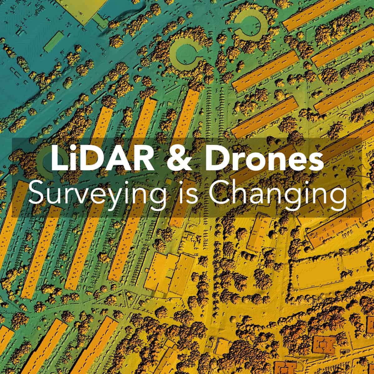
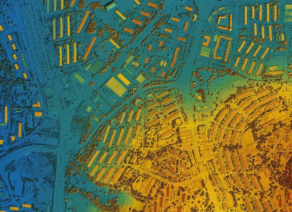
LiDAR (Light Detection and Ranging) is essentially a highly precise laser measurement system. It emits thousands to millions of laser pulses per second and calculates distances based on how long it takes for each pulse to return. This process creates a detailed 3D point cloud representing terrain, vegetation, and man-made features.
Unlike photogrammetry, LiDAR doesn’t rely on visible light, so it works in shaded areas, under forest canopies, or even at dusk. This makes it ideal for:
Use LiDAR in combination with existing GNSS survey points. Even a small number of well-placed ground control points (GCPs) can improve overall accuracy and make post-processing much easier.
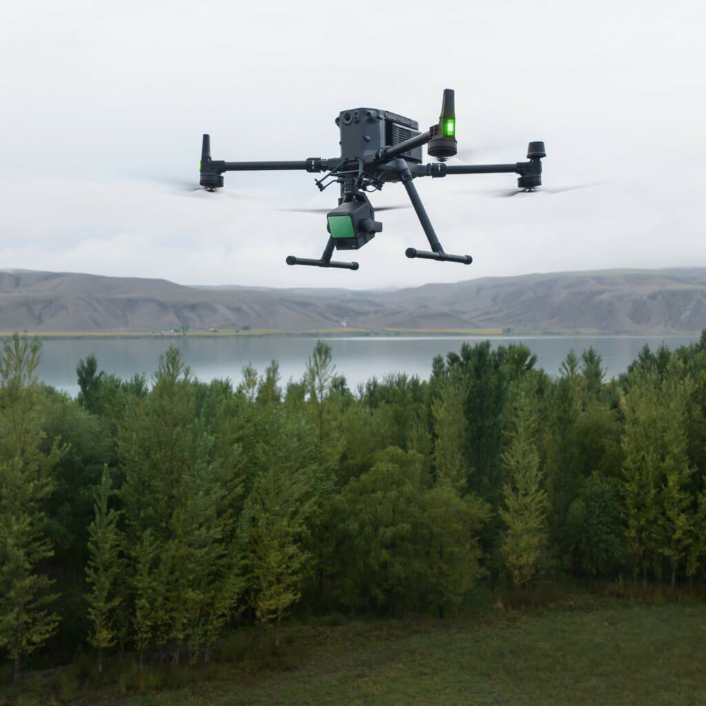
Mounting a LiDAR sensor on a drone transforms site surveying from multi-day, multi-crew operations into a single-operator workflow. Key components include:
Use RTK/PPK-enabled drones whenever possible. This reduces the number of GCPs needed, saves time in the field, and improves vertical accuracy, especially on sites with limited access for physical survey points.
LiDAR drones can cover 100+ acres in a single flight, which might take a ground crew days. For long linear features like roads or utility corridors, continuous flight paths allow seamless data capture without stopping for instruments or setups.
Schedule flights during calm weather conditions and low wind to reduce motion errors in point clouds. Early morning often provides the best light and minimal atmospheric interference.
Survey-grade LiDAR drones can achieve 1–5 cm horizontal and vertical accuracy with proper ground control and RTK/PPK corrections. Accurate elevation models mean fewer design conflicts and reduced construction risk.
Always validate a subset of points in the field with traditional survey methods to verify the drone data before using it for critical design decisions.
LiDAR can measure multiple returns per pulse, capturing canopy, mid-vegetation, and bare ground. This is particularly valuable for:
Adjust the LiDAR scan density depending on vegetation density. Denser foliage may require more passes or higher pulse repetition rates for accurate ground modeling.
Drones allow teams to safely capture data in hazardous or inaccessible areas: unstable slopes, traffic corridors, wetlands, or confined sites. Pair LiDAR surveys with aerial imagery to provide context for the point cloud. It’s useful for both safety assessments and stakeholder reporting.
Fewer field hours, reduced risk of human error, and faster turnaround can significantly reduce overall project costs.
Many teams combine both: use LiDAR for elevation and volumetric accuracy, and photogrammetry for high-resolution textures or site imagery. Integrating both datasets in a CAD or GIS workflow ensures the most complete and versatile output.
LiDAR is powerful, but successful implementation requires careful planning:
Start small. Pilot LiDAR on a limited area before scaling to full project sites. This allows your team to refine workflows and identify any gaps in hardware, software, or data management.
Demand for faster, more accurate site data is only growing. Developers, engineers, and contractors need:
At Bench-Mark, we’ve seen customers drastically reduce field time and rework once LiDAR was integrated into their workflow. Projects that used to require multiple crews and days of work can now be completed safely by a single operator in a fraction of the time.
Document lessons learned after each flight. Maintaining a library of flight parameters, weather conditions, and post-processing workflows improves efficiency and data quality over time.
If you’re planning subdivisions, laying out utilities, or tracking construction progress, DJI LiDAR can give you the speed, precision, and safety that modern projects demand.
Bench-Mark has helped surveyors and engineers across North America get started with RTK, total stations, and now drone LiDAR. Our team can guide you in choosing the right sensor, platform, and workflow to match your project’s unique requirements.
A LiDAR sensor uses laser pulses to capture 3D measurements of terrain and objects. On a drone, it can penetrate vegetation to create accurate ground models.
With proper ground control and RTK/PPK corrections, LiDAR drones can achieve 1–5 cm accuracy, suitable for most surveying and engineering tasks.
Both have strengths. LiDAR is better for elevation, vegetation, and volumetric measurements; photogrammetry is ideal for visual models. Using both together often yields the best results.
Entry-level setups start at $25,000; advanced survey-grade systems can exceed $150,000 depending on sensor, drone platform, and software.
Yes. In the U.S., an FAA Part 107 certificate is required. In Canada, a Basic or Advanced Drone Pilot Certificate is needed, depending on where and how you fly.
