
Getting started in land surveying starts with having the right tools from day one. The right land surveyor equipment can mean the difference between efficient, accurate results and wasted time in the field. A poorly equipped crew may spend hours trying to get things done. A well-prepared team can deliver reliable measurements efficiently and faster.
Surveying is also one of the most regulated technical professions in Canada. Crews are expected to deliver centimeter-level accuracy for projects ranging from new subdivisions to highway expansions, and even small equipment errors can lead to costly disputes or rework. With demand for surveyors rising due to infrastructure investment and housing development, it has never been more important for new teams to get started on the right foot.
At Bench-Mark, we’ve helped hundreds of survey crews across Canada and the U.S. get up and running with the essentials. Canadian professionals can access tools that fit their budgets, workflows, and long-term growth. If you’re building out your first survey kit or expanding your crew, here’s a breakdown of the equipment every new team should have to work accurately, efficiently, and safely.
Why Equipment Choice Matters
The Core Surveying Instruments
Field Essentials Every Crew Needs
Supplies That Keep Jobs Moving
Emerging Tools Worth Considering
Pro Tips for New Survey Crews
Start with the Right Foundation
Surveyors face a unique challenge: every point, every boundary, and every elevation has to be precise. A 3–5 cm error might not sound like much, but it can shift a property line enough to trigger legal disputes or force a redesign of utilities. Construction tolerances are often tighter than people realize. On road projects, even 2 cm of elevation error can affect drainage and asphalt thickness.
Reliable equipment reduces downtime too. A rover that loses RTK fix under tree cover can cost hours in reshoots. A total station tripod that slips mid-survey can force you to re-establish control points. Thus, the right kit protects accuracy and keeps projects on schedule.

The backbone of modern surveying is GNSS. With RTK GPS systems & GNSS receivers, surveyors achieve centimeter-level accuracy in real time by using corrections from a base station or network. Compared to post-processed GPS, RTK cuts turnaround time dramatically. Crews can stake roads, subdivisions, or utilities live in the field instead of waiting on office adjustments.
A few practical tips:
At Bench-Mark, our flagship Hemisphere S631 is trusted by Canadian surveyors because it balances performance and price. Unlike closed-system brands like Trimble, it integrates seamlessly with industry software like FieldGenius.
GNSS is powerful, but it can’t do everything. Total stations remain the precision tool for line-of-sight work. They’re indispensable for:
When shopping, prioritize:
For example, the GeoMax Zoom95 offers automated target tracking, which means fewer errors from manual sighting. This is especially valuable for new crews still learning the ropes.
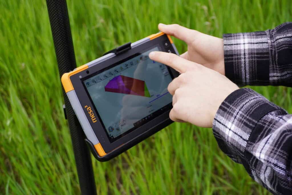
Survey software is where all your fieldwork gets tied together. In Canada, FieldGenius is the standard. It’s compatible with most GNSS and total stations, which keeps you from being locked into one manufacturer.
Key reasons software matters as much as instruments:
Train every crew member to export backups daily. Nothing stings more than losing a week’s data to a corrupt file.
Even the best instruments fail without reliable accessories. A professional crew should never leave the office without:
Consumables are easy to overlook, but losing them can stop work cold:
Keep an organized field kit. Crews lose hours digging through messy trucks for missing flagging or extra nails.
Technology is advancing quickly. New crews should plan when to integrate:
Adopting too early can strain budgets, but ignoring these tools entirely risks falling behind competitors.
Drawing from years of helping Canadian surveyors, here are the best practices worth adopting from day one:
Save your base positions and coordinate systems. Don’t average a new base every day, since data will shift.
Shoot a known monument before starting work. If your gear is off, better to catch it early.
Extra tribrachs, batteries, and cables prevent wasted trips. A $150 forgotten cable can cost $2,000 day in delays.
Always know how to finish the job if your GNSS fails; total station workflows should be ready.
Crews that understand projections, datums, and localization spend less time calling for help and more time collecting data.
Every survey crew needs a solid foundation of equipment. New teams can work confidently and competitively. The secret to success is investing early in reliable land surveyor equipment, building strong workflows, and standardizing best practices.
The Canadian market is unique: big dealerships often lock entire provinces into single brands, and surveyors are left paying a premium. We give crews access to professional-grade GNSS and total stations at fair prices, backed by Canadian support specialists who know both the technology and the regulatory landscape.
As infrastructure projects expand and demand for survey data grows, the crews who succeed will be those who combine the right instruments with smart training and scalable workflows. Start strong, stay consistent, and your equipment will pay dividends for years to come.At Bench-Mark, we’ve helped surveyors with the right mix of GNSS, total stations, and software. If you’re outfitting your first crew or scaling a growing operation, our team is here to help you choose the tools that fit your workflow and budget. Explore our land surveyor equipment choice to see how you can start with accuracy that lasts.
