
Before the first excavator moves dirt or the first concrete truck arrives, surveyors establish the control framework that guides every phase of construction. For land developers, civil engineers, and construction managers working on subdivisions, commercial sites, or infrastructure projects, construction surveying is essential for keeping projects accurate, on schedule, and within budget.
What Is Construction Surveying?
Why Surveying in Construction Matters
Core Functions of Surveying in Construction
The Tools That Power Modern Construction Surveying
How Surveying Connects Design to Execution
Accuracy Standards in the Field
Common Challenges and How Surveyors Address Them
Surveying Is the Foundation of Construction Accuracy
Construction surveying is the process of measuring, mapping, and staking out a site to ensure that what gets built matches the design exactly. Surveyors establish reference points and benchmarks that guide earthwork, foundation placement, structural alignment, and utility installation. They verify elevations, calculate volumes, and monitor progress throughout the build to confirm that execution stays aligned with engineering plans.
Engineers produce detailed drawings with precise coordinates and elevations. Surveyors take those numbers and mark them physically on the ground so crews know exactly where to dig, pour, or build. Without this, plans can’t be executed with confidence.
Accuracy in construction matters because a foundation that’s off by even a few centimeters can create cascading problems. This includes misaligned walls, drainage issues, structural stress, or conflicts with adjacent properties. Surveying eliminates inaccuracies and provides verified measurements at every stage of the project.
Surveying also protects against costly errors. When surveyors identify existing utilities, grade challenges, or boundary conflicts before excavation begins, they prevent damage, rework, and delays. For project managers, this means fewer change orders, better resource allocation, and smoother coordination between trades.
Beyond accuracy, surveying provides the documentation needed for regulatory compliance and project turnover. As-built surveys confirm that construction was completed to specification, giving owners and inspectors the verified records they need to approve final payment and occupancy.
Surveyors contribute across the entire construction timeline. Their work typically includes:
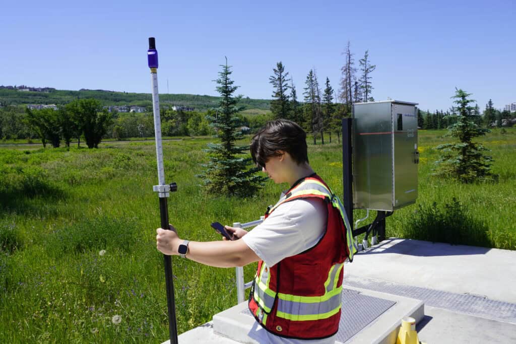
Surveyors set precise control points that guide excavation, foundation work, and structural placement. These markers ensure that every element of the project is positioned exactly where the design intends.
Proper site grading is conducted for water management, structural stability, and compliance with municipal stormwater requirements. Surveyors use RTK GNSS receivers and total stations to confirm that finished grades match design elevations.
Surveyors measure how much soil needs to be removed or added to bring a site to the required grade. These volumetric calculations directly impact project budgets and schedules, as earthmoving is one of the largest cost drivers in land development.
As-built surveys capture the actual conditions of a completed project compared to the original design. This documentation is essential for regulatory approvals, warranty claims, and future renovations.
Modern construction surveying relies on a combination of proven instruments and emerging technologies that deliver speed, precision, and field-ready data.
Total stations remain the basis of construction surveying. They measure both distance and angle simultaneously, making them ideal for setting layout points, verifying structural alignment, and checking elevations. Total stations are highly accurate and work well in environments where GNSS signals are obstructed by buildings or heavy canopy.
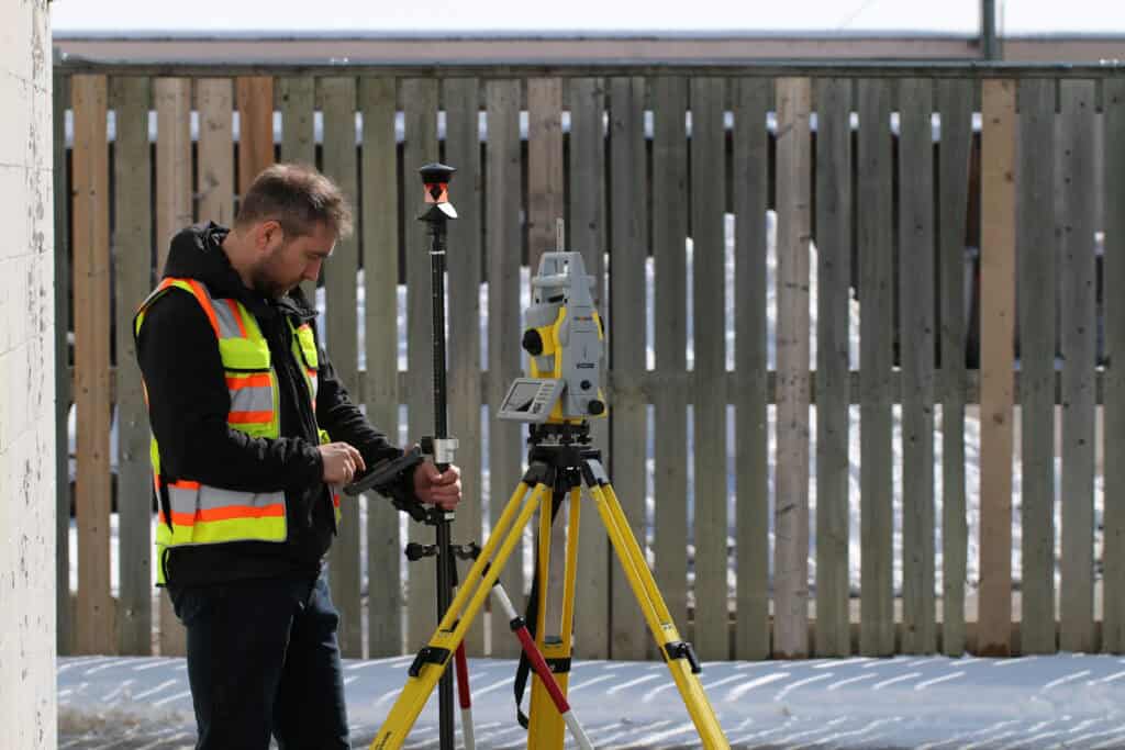
RTK GNSS receivers have transformed how surveyors work on open sites. RTK (real-time kinematic) technology delivers centimeter-level accuracy by using a base station or correction network to refine satellite signals in real time. For large-scale grading, roadwork, or subdivision layout, RTK equipment allows surveyors to move quickly across a site without the need for traditional setup over control points. Systems like the Hemisphere S631 are built specifically for this type of work, combining multi-constellation GNSS tracking with rugged, field-tested reliability.
UAVs (drones) equipped with RTK positioning provide rapid site mapping and progress monitoring. A drone can capture high-resolution aerial imagery and generate topographic models in a fraction of the time it would take a crew to survey the same area on foot. For earthwork contractors and project managers, this means up-to-date site intelligence that supports faster decision-making and more accurate volume calculations.
3D laser scanners capture millions of data points in minutes, creating highly detailed models of existing conditions or completed work. Laser scanning is especially valuable for complex sites, as-built verification, or clash detection, where precise spatial relationships matter.
These tools give construction surveyors the flexibility to choose the right instrument for the job.
Surveying makes engineering plans buildable. Designers work in a digital environment where coordinates, elevations, and alignments are perfectly defined. Surveyors take that digital model and translate it into physical markers that guide excavators, formwork crews, and equipment operators.
Surveyors must account for site conditions, verify that control points are stable and accessible, and ensure that layout work is coordinated with the construction schedule. They also monitor progress as work advances, checking that each phase is completed accurately before the next begins.
For land development projects, this coordination is critical. A subdivision might involve grading an entire site, installing underground utilities, pouring curbs and gutters, and paving roads all within a tight sequence. Surveyors give the verified measurements that keep each trade aligned with the overall plan.
Construction surveying operates to tighter tolerances than many people realize. Foundation layout might require accuracy within ±5 mm horizontally and vertically. Structural steel placement often demands even tighter control. For roadwork and grading, vertical accuracy of ±10 mm is common, while horizontal positioning might allow slightly more variation depending on the feature being staked.
These tolerances matter because construction builds on itself. If a foundation is off by a centimeter, that error compounds as walls, floors, and structural elements are added. Surveyors use calibrated equipment, proven procedures, and regular checks to maintain accuracy throughout the project.
Construction sites present unique challenges that require adaptation:
Experienced surveyors anticipate these challenges and adapt their approach accordingly. They establish redundant control points and use a mix of technologies to maintain productivity.
Construction surveying connects design intent to physical execution and provides the verified measurements that guide every trade. Surveyors ensure that construction stays aligned with the plan.At Bench-Mark, we’ve supported construction projects across Canada with the equipment and expertise needed for accurate, efficient surveying. Our team can help you choose the right tools and configuration to keep your work on track. Because in construction, accuracy is foundation.
