
Even in a world dominated by RTK GNSS, drones, and machine control, the automatic level still earns its place on Canadian job sites. When it comes to transferring elevations reliably, checking grades, and verifying vertical control, few tools are as simple, stable, and dependable.
An automatic level in surveying is often the quiet tool behind road construction, site development, and infrastructure projects. When GNSS struggles under tree cover or near structures, the auto level keeps projects moving.
What Is an Automatic Level in Surveying?
How an Automatic Level Works
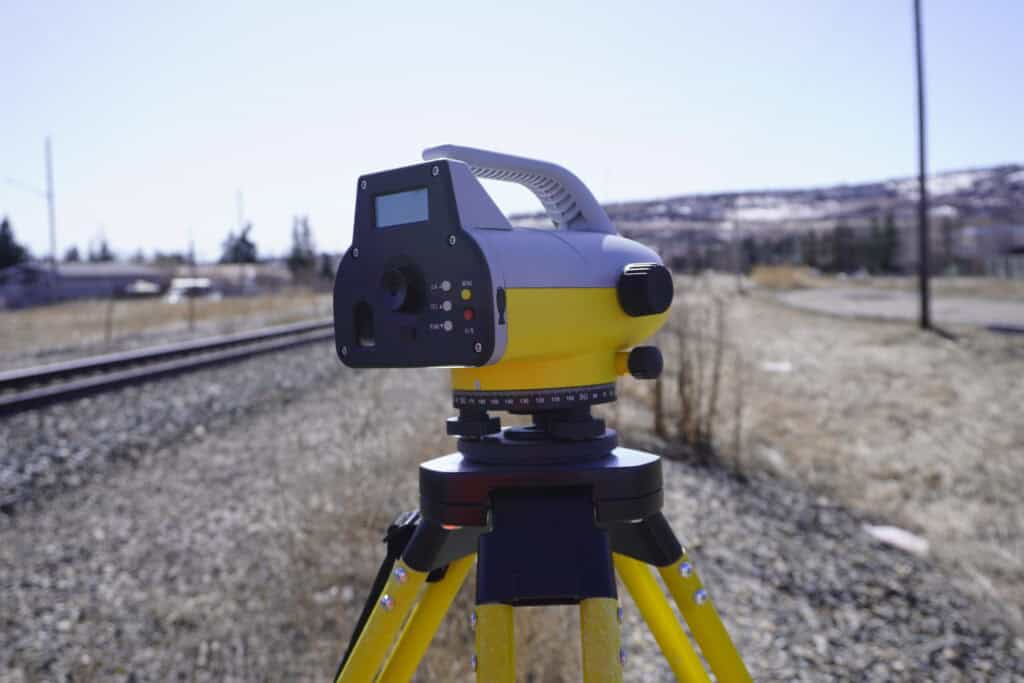
Core Components You Should Understand
Common Uses of an Automatic Level in Surveying
Accuracy: What You Can Expect in Real Projects
Automatic Levels vs GNSS and Total Stations
How to Set Up an Automatic Level Correctly
Best Practices for Reliable Measurements
Durability and Field Suitability in Canada
Where the Automatic Level Still Makes Sense Today
An automatic level is an optical surveying instrument used to establish or verify points on the same horizontal plane. It’s primarily used to measure height differences between points using a graduated staff, often called a leveling rod or stadia rod.
What separates an automatic level from older manual levels is the internal compensator. Instead of requiring the operator to perfectly level the instrument using screws alone, the compensator automatically corrects small tilts and keeps the line of sight horizontal once the bubble is roughly centered.
In practical terms, that means faster setup, fewer errors, and more consistent results.

An automatic level looks simple: a telescope mounted on a base, attached to a tripod. Internally, however, there’s a precision compensator system doing the job.
Once the instrument is mounted and roughly leveled, the compensator uses a pendulum-style mechanism with prisms or mirrors to maintain a true horizontal line of sight. As long as the instrument is within its leveling range, the compensator continuously corrects small movements caused by wind, vibration, or minor tripod settlement.
This is why automatic levels are so effective for repetitive elevation checks. You’re not constantly re-leveling the instrument. You focus on reading the rod and recording data.
Automatic levels vary by brand and accuracy class, but the main components remain the same.
These components work together to deliver consistent elevation measurements without the complexity of electronic systems.
Automatic levels are all about vertical accuracy. They’re used anywhere elevation matters more than horizontal position, which is often the case in construction and civil work. In Canadian surveying and construction, automatic levels are most commonly used for:
They’re especially valuable during early construction phases, when crews need fast confirmation that work is on grade before moving forward.
Automatic levels don’t deliver centimeter-level 3D coordinates like RTK GNSS, but that’s not their job. Their strength lies in precise vertical measurement over short to medium distances.
Survey-grade automatic levels typically achieve accuracy in the range of 1-2 mm per kilometer of double-run leveling when used correctly. For most construction and roadwork applications in Canada, that’s more than sufficient.
Accuracy depends on more than the instrument itself. Rod quality, setup technique, sight distances, and environmental conditions all play a role. Balanced foresight and backsight distances, firm tripod placement, and stable ground are just as important as the level’s specifications.
It’s tempting to think newer technology makes automatic levels obsolete, but in practice they complement each other.
GNSS excels at positioning across large areas, especially in open-sky environments. Total stations work well in tight spaces and complex geometry. Automatic levels are in the vertical control niche. They offer simplicity and reliability without relying on satellites or batteries.
In many Canadian projects, surveyors use all three tools together. GNSS establishes control, total stations handle layout, and automatic levels verify grades and elevations.
Fortunately, a proper workflow is straightforward and repeatable.
Always take time to ensure the rod is plumb. Even a small tilt can introduce measurable error over distance.
Consistency is everything when using an automatic level. These habits make a noticeable difference in data quality.
These practices matter just as much on a quiet subdivision project as they do on a major highway job.
Automatic levels are built with reality in mind. Most survey-grade models are sealed against dust and moisture and operate reliably across wide temperature ranges. That durability is a big reason they’re still trusted on road construction, utility, and industrial sites. When electronics struggle with cold or moisture, an optical level keeps working.
At Bench-Mark, we see automatic levels used every day alongside GNSS and total stations. Choosing the right tool for the task is what keeps projects efficient and accurate.
The automatic level in surveying fills a different role than an RTK GNSS. When you need dependable elevation transfer, fast setup, and confidence that your vertical control hasn’t drifted, it’s hard to beat.
For Canadian surveyors, contractors, and engineers, the automatic level remains a practical, cost-effective tool that complements modern positioning systems. It’s simple, predictable, and proven. Sometimes, the most effective solution is the one that delivers reliable results without getting in the way.
