Description
Revolutionize Your Surveying Experience with the AU20 LiDAR System
Welcome to the future of precision surveying! Introducing the AU20 LiDAR system by CHCNAV – a game-changing solution designed to cater to the discerning needs of engineers. With outstanding accuracy, premium laser capabilities, and industrial reliability, the AU20 is the ultimate tool to empower engineers with unmatched precision and efficiency.
Outstanding Accuracy: Pioneering Precision
Engineered with CHCNAV’s cutting-edge high-precision navigation algorithm, refined over two decades of dedicated research, the AU20 is a marvel of accuracy. Complemented by an impressive 5 mm repeated ranging accuracy, the system achieves an exceptional absolute accuracy of 2 to 5 cm. This remarkable precision remains unwavering even in the most challenging and demanding environments, ensuring your data is always on point.

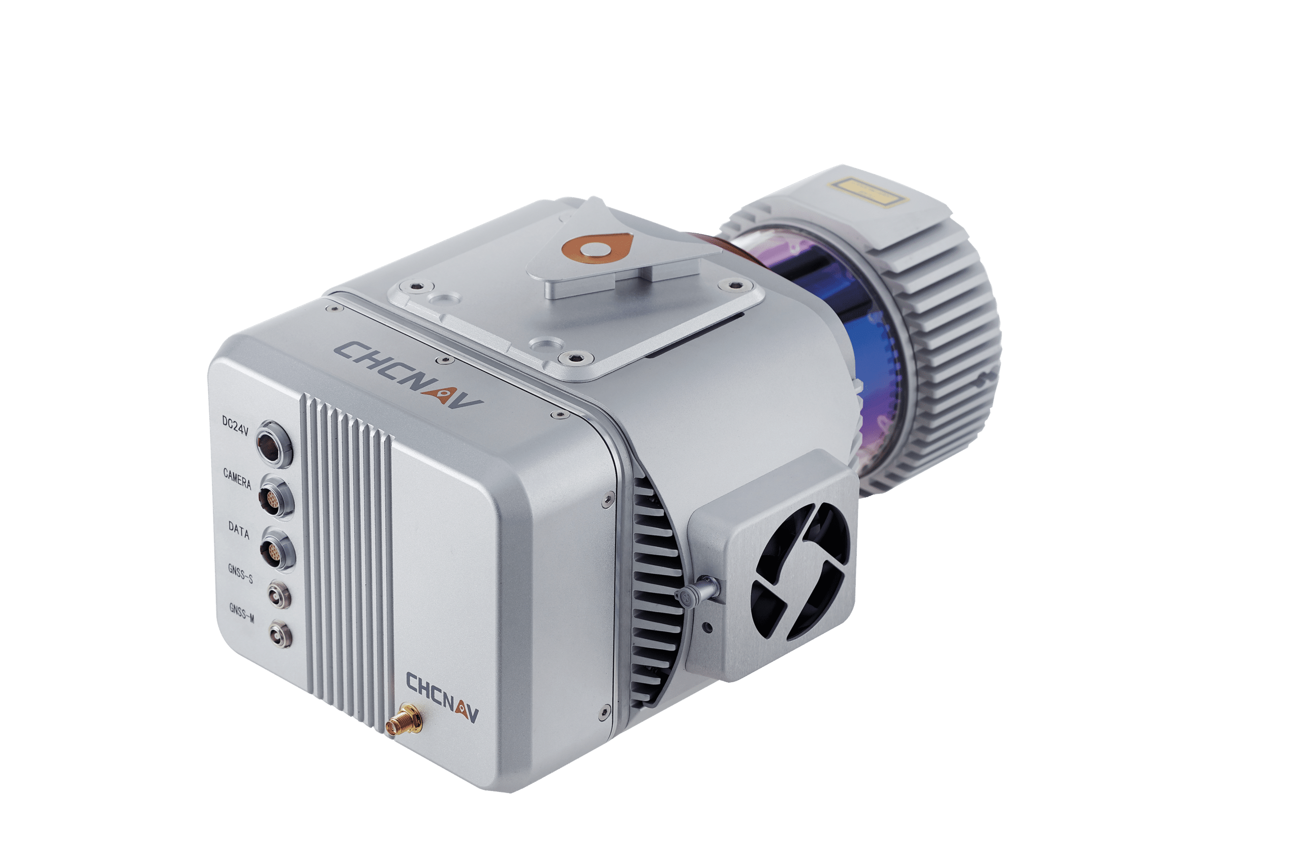
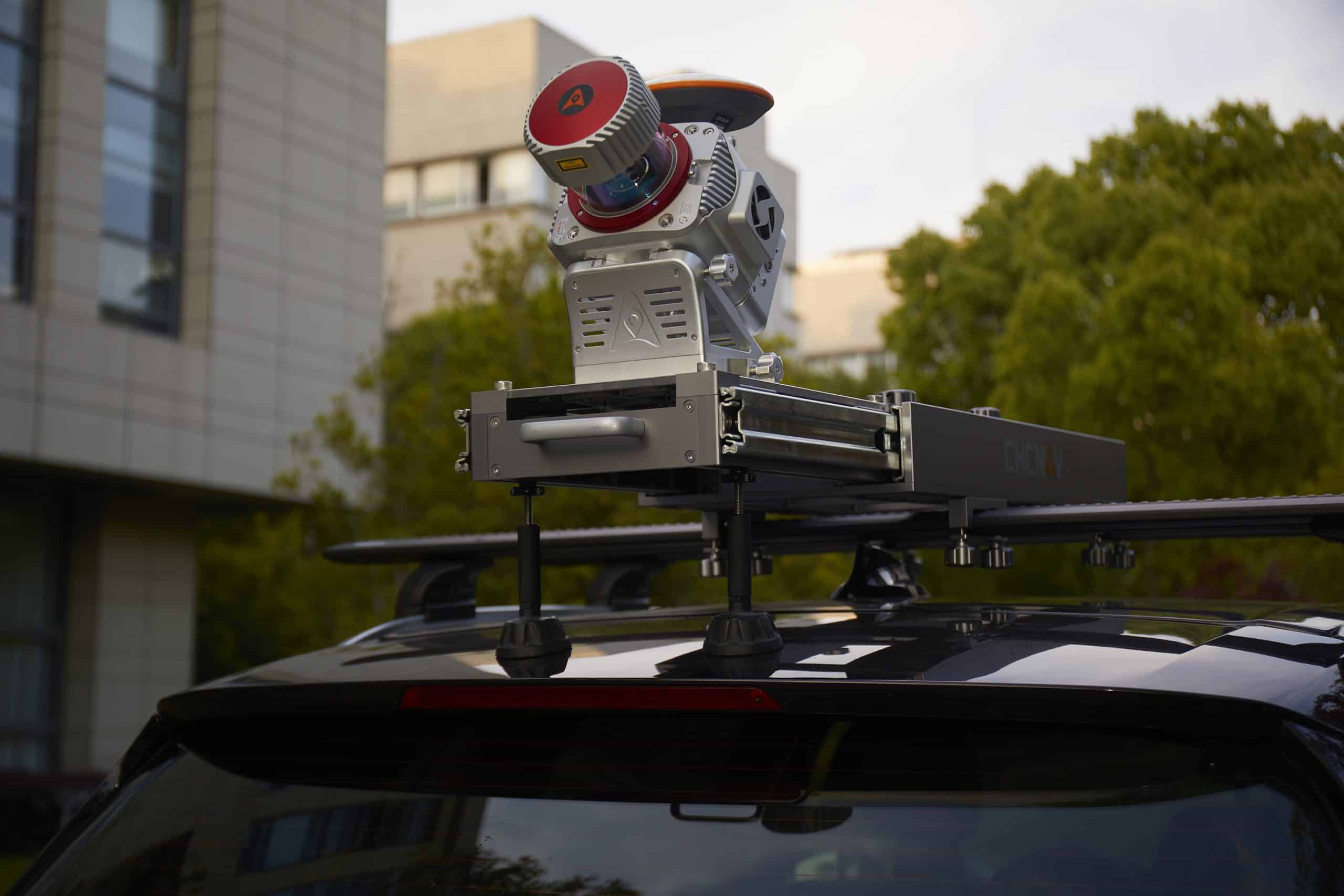
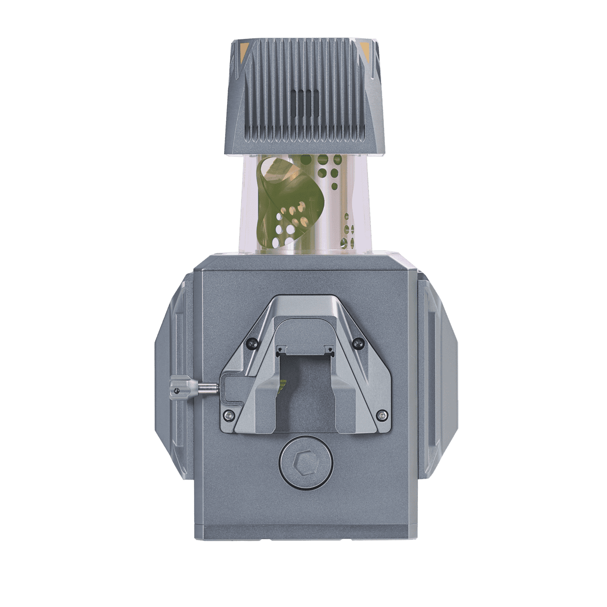
Premium Laser Performance: Unveiling Unmatched Capabilities
Unlock a new realm of surveying possibilities with the AU20’s premium laser features. Boasting a long-range survey capacity of up to 1450 meters, coupled with rapid scanning at an astounding 2 million points per second, and a seamlessly rotating mirror enabling up to 200 scans per second, the AU20 redefines detail. Critical tasks are now supported with unparalleled clarity and intricacy.
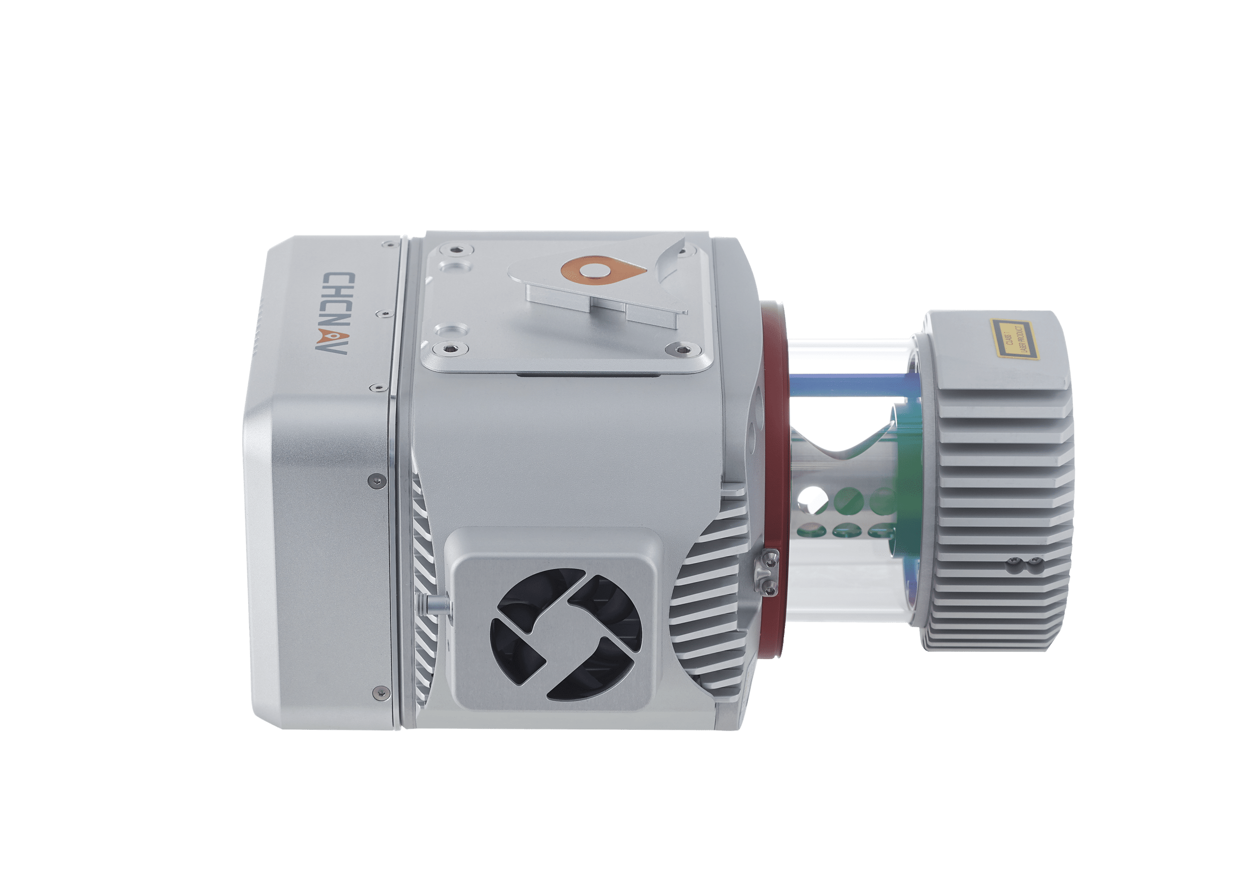
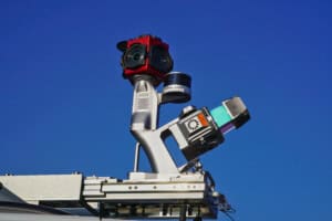
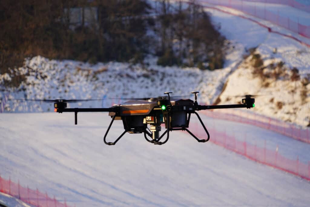
Industrial Reliability: Unyielding Performance
In the world of survey missions, unpredictability is inevitable. Weather fluctuations and site challenges can pose hurdles, but with the AU20, you’re equipped with industrial reliability. CHCNAV’s Alpha family systems are fortified to excel in any field environment, ensuring your operations remain steadfast and dependable, no matter the conditions.
Lightweight Efficiency: Effortless Maneuverability
Experience the freedom of mobility with the AU20 LiDAR system. Weighing in at a mere 2.82 kg, this system is incredibly lightweight and compact. With the innovative car mount kit, featuring the Ladybug5+, the combined weight is a mere 10.7 kg, making the AU20 a truly portable powerhouse.
Multi-Platform Versatility: Adaptable to Your Needs
The AU20 adheres to CHCNAV’s time-tested multi-platform LiDAR design concept, offering unmatched versatility. It finds its place on both manned and unmanned aircraft for aerial scanning, as well as on an array of land vehicles including cars, boats, and trains for mobile mapping. Even on foot, the AU20 can be effortlessly mounted on a backpack for narrow area mapping, adapting to your surveying needs seamlessly.
Efficient Workflow: Streamlined Precision
CHCNAV paves the way for a comprehensive LiDAR surveying solution with the AU20. Experience fully automated reality capture and real-time mission monitoring through the SmartGo software. Intelligent point cloud processing is made possible through the CoPre desktop software, ensuring your workflow is not only efficient but also remarkably precise.
Robust Penetration: Overcoming Challenges with Ease
Navigating through challenging environments with dense vegetation is a breeze for the AU20. Its advanced multi-target capability supports up to 16 target echoes, granting superior penetration ability. Accurately capturing ground surfaces and generating Digital Elevation Models (DEMs) and Digital Surface Models (DSMs) becomes effortlessly achievable, even in the most demanding circumstances.
Seamless Integration: Effortless Setup
Experience hassle-free installation with the AU20’s Alphaport technology. A single click connects the system to its power source and camera, streamlining the setup process for you.

Flexible and Efficient LiDAR Solutions: Redefining Possibilities
The AlphaUni 20 emerges as a cost-effective, multi-platform mobile mapping system that redefines your surveying capabilities. With six years of innovation and product development powered by CHCNAV’s state-of-the-art LiDAR technology, the AU20 delivers unparalleled data quality, accuracy, and density. Its flexibility in installation, combined with CHCNAV’s cutting-edge technology, ensures your data surpasses expectations. The AU20 democratizes the reality capture industry, making precision accessible to all. From road surfaces to asset management, the AU20 adapts to your needs, putting the power of comprehensive mapping in your hands.
Elevate Your Engineering Surveys with AU20
Discover a new era of surveying with the AU20 LiDAR system. Precision, versatility, and reliability converge to redefine what’s possible in engineering applications. Whether you’re capturing expansive landscapes from the skies or maneuvering through dense vegetation on the ground, the AU20 empowers you with data accuracy that’s second to none. Experience the future of surveying – experience the AU20.

Reviews
There are no reviews yet.