Home > Surveying Equipment > Survey Drones
Why trust Bench Mark
At Bench Mark, we have a long history of integrating RTK with numerous different systems. This includes survey drones, machines, and anything else that can move and needs a position. So whether you are looking to produce volume reports, monitor stockpiles, generate surfaces, and 3D maps, we have you covered here at Bench-Mark. We pride ourselves in being able to provide customized solutions to our customers to meet all of their needs. When you choose Bench Mark you’re choosing a partner that can meet all your geospatial needs.
LiDAR (Light Detection and Ranging) and photogrammetry are two distinct surveying techniques. LiDAR drones use laser pulses to measure distances to objects on the ground, creating highly accurate point clouds. Photogrammetry drones, on the other hand, capture high-resolution images and use software to create 3D models by analyzing the overlapping images. LiDAR is ideal for capturing elevation and terrain data with precision, while photogrammetry excels in creating detailed visual models.
LiDAR-equipped drones offer several advantages for surveying:
Yes, photogrammetry drones are well-suited for detailed site inspections and 3D modeling. They capture high-resolution images from multiple angles and use specialized software to stitch them together, creating accurate 3D models. This technology is valuable for architectural, construction, and archaeological projects where visual representation and detailed measurements are essential.
LiDAR and photogrammetry drones find applications in various industries, including:
Yes, there are regulatory requirements for operating survey LiDAR and photogrammetry drones, which vary by country and region. In the United States, for example, the Federal Aviation Administration (FAA) regulates drone operations. Operators typically need to obtain a remote pilot certificate, follow airspace restrictions, and comply with safety guidelines. Additionally, specific permissions may be required for conducting drone surveys in sensitive areas or near airports. It’s essential to research and adhere to local regulations and obtain necessary permits before conducting survey drone operations.
Dedicated to outstanding quality
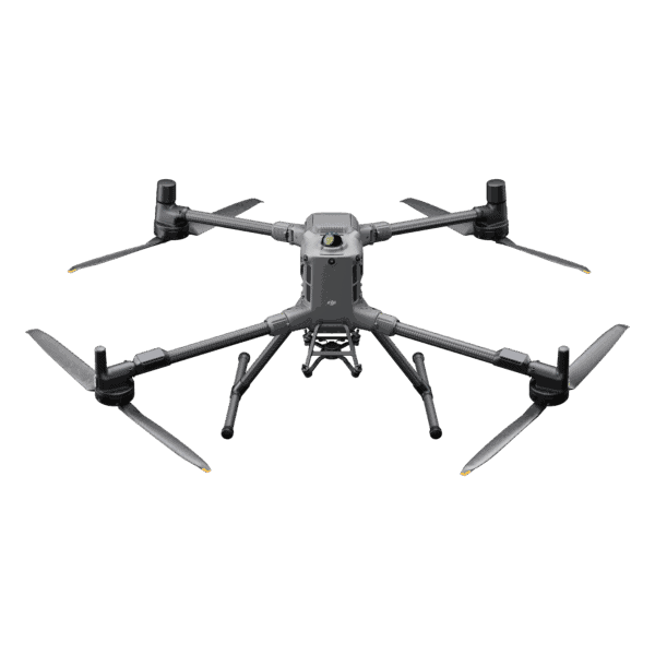
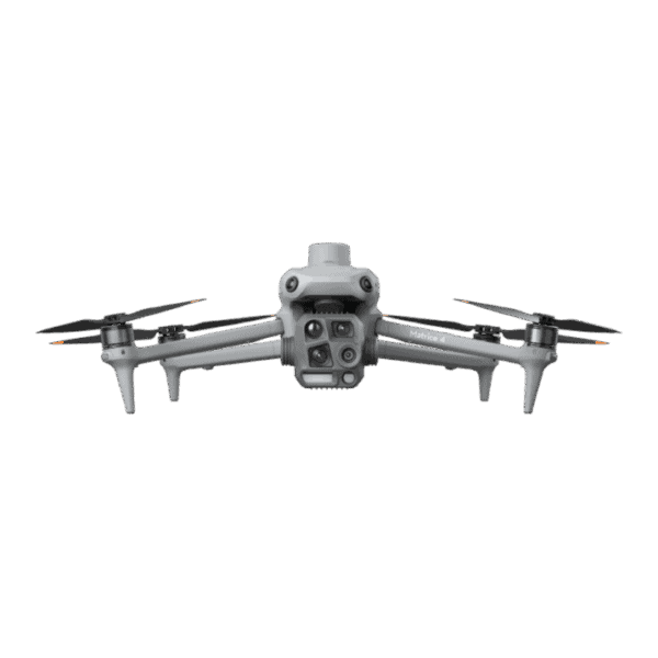
We offer cutting-edge drone solutions, including those by DJI like the Mavic 3 and Matrice 350. These drones are capable of taking multiple different payload solutions to meet your needs. This includes multiple LiDAR and camera options. Whether you require LiDAR for detailed terrain mapping, high-resolution cameras for aerial photography, or specialized sensors for industrial inspections, we offer a comprehensive selection of payload solutions compatible with these DJI drones. These payloads are designed to seamlessly integrate with survey drones, ensuring reliable and precise data collection.

Trust Bench Mark with Your Projects
Bench Mark supplies professional survey drones and drones for surveying for mapping, photogrammetry, GIS, and infrastructure inspection. Popular models available for order include the DJI Matrice 400 Survey Drone, DJI Matrice 350 Enterprise RTK, DJI Matrice 4E RTK, DJI Mavic 3 Enterprise RTK, and the Autel Robotics Evo II RTK Drone. Each system is selected for accuracy, flight stability, and real-world surveying performance.
We support every purchase with expert product guidance and responsive technical support to keep your operations running smoothly. From new enterprise UAVs to select used systems at competitive pricing, Bench Mark delivers reliable drone solutions for professional surveying applications.