
Land surveying is an essential discipline underpinning construction, land management, and infrastructure development. Surveyors have long relied on total stations to achieve the precision required for accurate measurements. While total stations remain indispensable tools, Real-Time Kinematic (RTK) GPS technology has emerged as a complementary and transformative solution. With the latest RTK systems, in many applications the total station can now be left behind.
For surveyors currently relying solely on total stations, understanding how RTK GPS can enhance workflows is key to staying ahead in a competitive industry. This article explores the benefits of RTK GPS, compares it to total stations, and explains how it can revolutionize your approach to land surveying. Check out our video below on switching from total stations to RTK.
What Is RTK GPS and How Does It Differ from Total Stations?
Why RTK GPS Enhances Total Station Workflows
Applications Where RTK GPS Shines
Transitioning from Total Stations to RTK GPS
Benefits of RTK GPS for Total Station Users
The Future of Surveying with RTK GPS
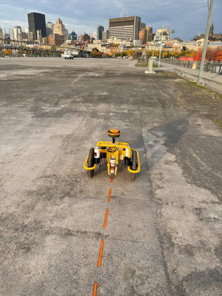
RTK GPS is an advanced satellite positioning system that delivers centimeter-level accuracy in real time. It uses two components—a stationary base station and a mobile rover—to correct GPS signals and provide highly accurate location data. We have a video on how RTK works! Check it out here: What is RTK and How Does it Work?
In comparison, total stations rely on direct line-of-sight measurements between a prism and an instrument, limiting their use in obstructed environments. Here’s how the two compare:
| Aspect | Total Station | RTK GPS |
| Accuracy | High (Millimeter Level For Short Distances, depends on instruments angular accuracy) | High (8 mm +/- 1 ppm Horizontal, 1.5 mm +/- 1 ppm Vertical) |
| Line of Sight | Required to make any measurement. | Not required |
| Range | Limited to line of sight to the total station | Can achieve 10+ km on internal radios or anywhere NTRIP coverage exists. |
| Speed | Time-intensive for large areas, especially when line of sight is restricted and a large number of traverses are required. | With no traversals required, you can cover much larger areas much quicker. |
While RTK GPS offers significant advantages, there are still areas where it is better to use a total station. Often times, having both tools available will give the best outcomes.
1. Eliminating Line-of-Sight Limitations
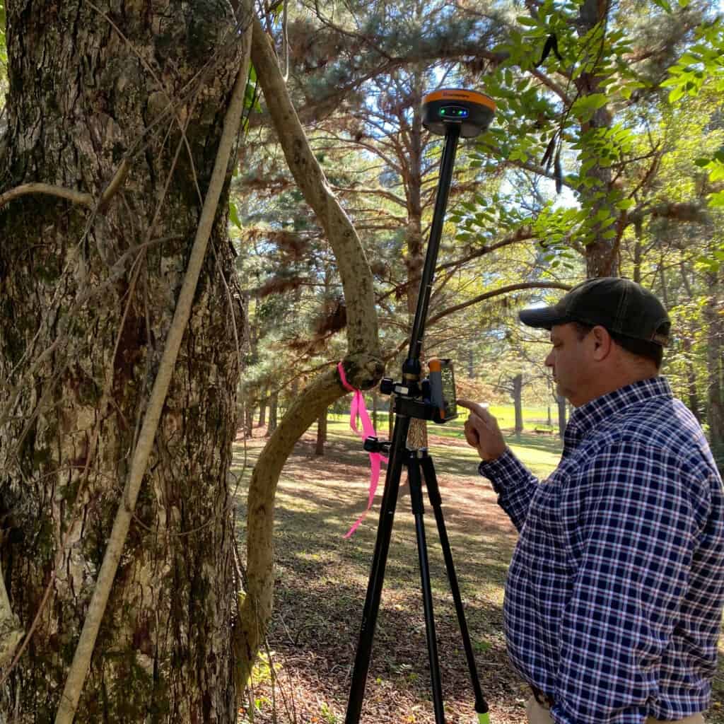
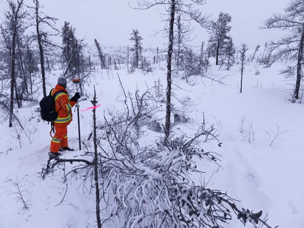
Surveyors often encounter challenges when working in areas with dense vegetation, rugged terrain, or urban obstructions where total stations struggle. RTK GPS, which relies on satellite signals, can operate effectively in these conditions without requiring a clear line of sight. With modern 7th generation systems like the Hemisphere S631, surveying in dense canopy is possible, somewhere only total stations have been to survey in the past. This often required cutting sight-lines and difficult traverses through tough terrain.
Applications include:
2. Increasing Efficiency in Large-Area Surveys
Large sites can be labor-intensive and time-consuming to survey with total stations due to the need to perform multiple traversals. This can lead to errors compounding, and reducing the accuracy of each subsequent total station shot. RTK GPS allows surveyors to move freely across vast terrains, collecting data faster without sacrificing accuracy.
For example:
3. Providing Real-Time Data
With total stations, data often needs to be post-processed for accuracy verification, delaying decision-making. RTK GPS eliminates this bottleneck by offering real-time corrections, allowing surveyors to validate and adjust measurements on-site.
For example:
4. Enhancing Flexibility
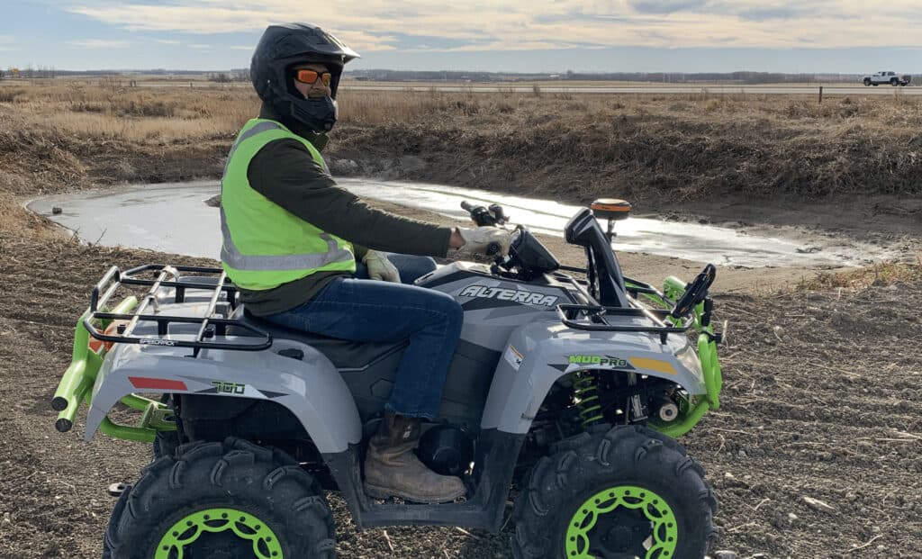
RTK GPS equipment is lightweight and portable, offering greater mobility than total stations. Its integration with drones further expands its versatility, enabling surveyors to conduct aerial surveys with survey drones with the same centimeter-level accuracy. On top of this, RTK base stations can be used to provide real-time information to multiple different operators at the same time. Instead of relying on one total station for each individual surveyor, you can use a single base station to power multiple pieces of equipment or different surveyors.
For example:
Boundary Surveys
RTK GPS streamlines property boundary mapping by delivering highly precise measurements, even in challenging environments like wooded or uneven terrain. With a total station, you often require multiple different traversals of your equipment just to capture property corners, let alone any other features. With RTK, you simply set your base and capture the points without having to adjust the base station. This potentially turns a multi-day job into a single afternoon project.
Topographic Mapping
High-resolution topographic maps are critical for infrastructure planning and environmental assessments. RTK GPS accelerates data collection for such projects, enabling faster project turnaround times. With features like FieldGenius’s auto-recording, you can attach your RTK to a vehicle and drive your terrain, recording a point over a time or distance interval. There is no need to aim the total station, stay in line of sight of the total station, or move your total station as the terrain changes. With RTK you can simply drive your terrain to capture the contours.
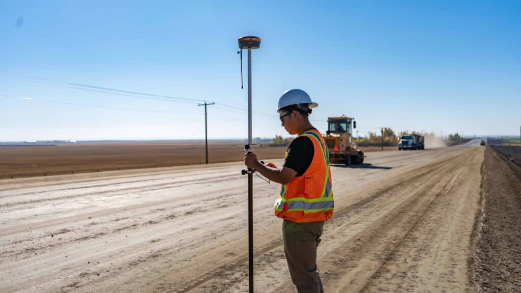
Construction Stakeouts
RTK GPS simplifies the layout of foundations, utility lines, and road alignments by providing real-time precision. This ensures that construction follows design specifications without delays or costly errors. When paired with FieldGenius’s nearest point feature and a tilt sensor you can be up the 50% faster when collecting and laying out points.
Resource Exploration and Mining
Another great application for RTK is in mining and resource exploration, where being able to cover large distances quickly and still provide a high level of accuracy is required. It is often not practical to set up a total station to record a single point, especially when you are recording over 10’s or even 100’s of squared kilometers. With RTK you can still achieve sub-centimeter level accuracy without recreating Lewis and Clark’s expedition with your total station.
There are countless other applications RTK can be used for, in everything from LiDAR mapping, robotics, autonomous vehicles and many, many more surveying related applications.
Initial Costs
RTK GPS systems require an upfront investment that are often comparable to significantly less then total stations (depending on the angular accuracy of your instrument). However, these costs are quickly offset by the efficiency, accuracy, and long-term savings they provide. With RTK, you often only require a single operator, and can finish projects significantly faster.
Training
Surveyors familiar with total stations may need some training to master RTK GPS systems. However, surveying with RTK is very similar to using a total station, and often much easier. On top of this most survey software can run both total stations and RTK, meaning it is pretty easy to make the switch between the two. Here at Bench-Mark, we offer comprehensive training on getting started with RTK. This includes live Zoom training, live tech support, and our training library at Survey-Assistant.com.
Complementary Use
RTK GPS doesn’t replace total stations but complements them. Surveyors can rely on total stations for short-range, ultra-high-precision tasks (like bridge construction) while using RTK GPS for larger areas or highly obstructed environments.
| Benefit | How it Enhances Your Workflow |
| Time Efficiency | Survey large areas faster, reducing field hours. |
| Improved Accuracy | Achieve sub-centimeter level precision without line of sight, reducing operator error. |
| Real-Time Data | Validate measurements instantly, reducing post-processing delays. |
| Versatility | Integrated different pieces of equipment like drones, machines, perform static surveys for control points and more. |
| Cost Savings | Reduce labour and crew costs. |
RTK GPS technology continues to evolve, with advancements such as improved satellite coverage, AI integration, and enhanced correction services. These innovations will further cement RTK GPS as a cornerstone of modern surveying.
Surveyors who embrace this technology today will be well-positioned to tackle future challenges and capitalize on emerging opportunities in land management, infrastructure development, and beyond.
For surveyors who currently rely on total stations, RTK GPS is not just an alternative—it’s an enhancement. By combining the precision of total stations with the efficiency and flexibility of RTK GPS, surveyors can overcome limitations, streamline operations, and deliver superior results.
Whether you’re defining property boundaries, mapping topography, or supporting construction projects, RTK GPS empowers you to work smarter and achieve success in an increasingly demanding field.
No, RTK GPS complements total stations rather than replacing them entirely. While RTK GPS excels in large-area surveys and environments with obstructed sightlines, total stations are still indispensable for tasks requiring ultra-high precision, such as bridge construction or short-range stakeouts. Combining both tools provides optimal flexibility and accuracy.
Modern RTK GPS systems, like the Hemisphere S631, use advanced satellite constellations (GPS, GLONASS, BeiDou, Galileo) and correction algorithms to maintain high accuracy in challenging environments. These systems can often perform well even in dense canopy or urban areas with obstructed signals.
The initial cost of RTK GPS systems is often comparable to mid-range robotic total stations. However, RTK GPS typically provides faster project completion, reduced labor needs, and fewer errors, leading to significant long-term cost savings. Additionally, RTK systems often require only one operator, further reducing costs.
For surveyors experienced with total stations, the transition to RTK GPS is relatively straightforward. Most modern RTK systems have intuitive interfaces, and many survey software programs support both tools, allowing for a seamless integration into existing workflows. Training and support resources, such as those offered by Bench-Mark, can further ease the transition.
RTK GPS offers unparalleled efficiency for large-scale surveys, eliminating the need for traversals and reducing the time required to collect data. It also provides real-time corrections, enabling on-the-spot validation of measurements. This combination of speed, accuracy, and reliability makes RTK GPS ideal for projects like topographic mapping, property boundary surveys, and infrastructure planning.
Bench Mark Equipment & Supplies is your team to trust with all your surveying equipment. We have been providing high-quality surveying equipment to land surveyors, engineers, construction, airborne and resource professionals since 2002. This helps establish ourselves as the go-to team in Calgary, Canada, and the USA. Plus, we provide a wide selection of equipment, including global navigation satellite systems, RTK GPS equipment, GNSS receivers, and more. We strive to provide the highest level of customer care and service for everyone. To speak to one of our team today, call us at 403-286-0333 or email us at [email protected].
