

The DJI Matrice 4E has entered the surveying market as DJI’s latest entry-level mapping drone, and it’s forcing surveyors to ask a hard question: can a sub-$5,000 drone really deliver the accuracy we need for land surveying work? The short answer is: it depends on what you’re surveying and what tolerance you can accept. Let’s break down what the Matrice 4E delivers, where it falls short, and whether it makes sense for your workflow.
What the DJI Matrice 4E Brings to Surveying
Where the Matrice 4E Falls Short for Professional Surveying
When the Matrice 4E Makes Sense for Surveyors
Integration with Your Existing Survey Workflow
Know What You’re Buying
The Matrice 4E is DJI’s attempt to make drone surveying accessible to smaller firms and solo operators. At just over 2.5 pounds, it’s genuinely portable. You can throw it in a backpack, drive to site, and be in the air collecting data within minutes. For surveyors who’ve hauled traditional equipment through rough terrain, that convenience is real.
The drone comes with integrated RTK positioning, which is the core feature that makes it relevant for surveying work. With RTK enabled and a proper correction source, the Matrice 4E can achieve horizontal accuracies in the 2-5 cm range and vertical accuracies around 3-7 cm without ground control points. That’s tight enough for preliminary site analysis, volumetric calculations on stockpiles, and general mapping work where you’re after visual context with reasonable precision.
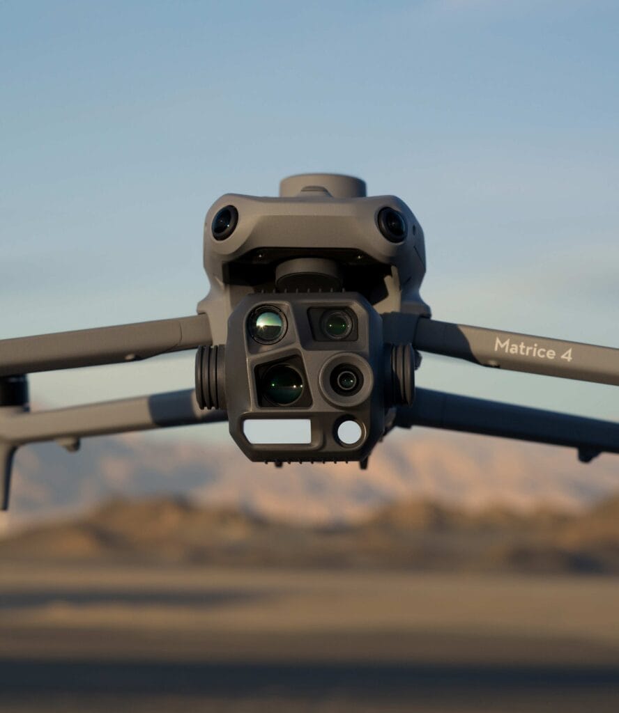
The camera setup includes a 20MP wide-angle sensor on a 4/3-inch CMOS, plus medium telephoto and telephoto cameras for flexibility. The mechanical shutter is critical here because it eliminates rolling shutter distortion when the drone is moving, which means cleaner photogrammetry results. You can cover roughly 2 km² per flight at a 5 cm ground sample distance (GSD), which translates to about 500 acres in a single battery cycle under good conditions.
DJI pairs the Matrice 4E with their Terra software for processing, and the integration is smooth. You plan missions in DJI Pilot 2, fly the grid, and push the data into Terra for orthomosaic generation, digital surface models (DSMs), and point clouds. The Real-Time Terrain Follow feature adjusts altitude on the fly to maintain consistent GSD over variable topography, which helps in hilly or sloped sites.
Here’s where expectations need to be managed. The Matrice 4E is not a survey-grade system in the way a Hemisphere S631 with FieldGenius or a Trimble total station is. It’s a mapping drone that can produce survey-adjacent deliverables, but it has clear limitations that matter for boundary work, construction staking, or any application where you’re legally certifying accuracy.
While 2-5 cm horizontal accuracy sounds good on paper, that’s under ideal conditions with a strong RTK correction signal. In reality, you’ll see accuracy degrade near obstructions, under tree canopy, or in areas with poor satellite visibility. Most professional surveyors still drop ground control points (GCPs) to validate and improve accuracy, which reintroduces field time and defeats part of the “efficiency” argument.
For comparison, a well-calibrated RTK rover like the S631 consistently delivers sub-centimeter horizontal accuracy and 1-2 cm vertical accuracy with proper technique. The Matrice 4E can’t match that, and it’s not designed to.
Vertical accuracy is always the weak point in photogrammetry-based drone surveys, and the Matrice 4E is no exception. Even with RTK, vertical precision hovers around 5-7 cm at best, and often worse in low-contrast terrain or areas with dense vegetation. If you’re doing cut-and-fill calculations, grading verification, or any application where elevation matters, you’ll want to validate with check shots using traditional RTK equipment.
The Matrice 4E is a camera-based system, which means it only sees the top surface. If you’re surveying forested areas, heavy brush, or anywhere vegetation obscures the ground, you’re out of luck. You’ll get a beautiful model of the tree canopy, but no bare earth data. For that, you need LiDAR, which the Matrice 4E doesn’t support. DJI’s higher-end systems like the Matrice 350 RTK with the Zenmuse L2 payload can handle that, but you’re now looking at a $30,000+ investment.
The Matrice 4E maxes out at 12 m/s wind resistance (about 27 mph), which sounds reasonable until you’re trying to fly in typical spring conditions or elevated terrain. The drone will refuse to take off or return to home automatically if conditions exceed limits, and you’ll lose productive field days. It also lacks the rugged build quality of industrial drones. The IP rating is unspecified, which means you shouldn’t count on flying in light rain or dusty conditions the way you might with a Matrice 400.
While the Matrice 4E does support RTK, it’s not as robust as the multi-constellation, multi-frequency GNSS receivers built into dedicated survey equipment. In challenging satellite environments (urban canyons, heavy tree cover, or magnetic interference zones), you’ll see more dropouts and longer initialization times compared to a true survey-grade RTK system.
Despite its limitations, the DJI Matrice 4E has a legitimate place in a surveyor’s toolkit, but it’s a supplement, not a replacement.
If you’re bidding on a large site and need to quickly understand topography, access points, and rough volumes before committing to a full survey, the Matrice 4E is perfect. You get a visual overview and serviceable elevation data without deploying a full crew.
For material volume calculations on gravel piles, dirt mounds, or demolition debris, the Matrice 4E delivers adequate accuracy. Most stockpile volumes have tolerance ranges of 2-5%, and the drone easily fits within that. You’ll still want to drop a base point or two for validation, but you can knock out a dozen stockpile measurements in an afternoon.
Contractors and civil engineers increasingly want visual progress documentation alongside traditional survey data. The Matrice 4E excels here because it produces high-resolution orthomosaics that show site conditions over time. Pair that with periodic check shots using RTK equipment, and you have a complete picture without flying a crew to site weekly.
If your project spec allows for 5-10 cm accuracy and primarily needs visual context (site plans, preliminary grading analysis, or environmental assessments), the Matrice 4E is more than capable. You’ll complete the work faster and cheaper than traditional methods.
The DJI Matrice 4E doesn’t replace your Hemisphere S631, total station, or FieldGenius setup, but it can extend their capabilities. Here’s how to think about integration:
The key is understanding that drone data and traditional survey data serve different purposes. Drones give you comprehensive visual coverage and surface modeling across large areas. RTK equipment gives you certified point positions with legal defensibility. Use each tool where it makes sense.
The DJI Matrice 4E is a capable, affordable entry point into drone surveying, but it’s not a replacement for survey-grade RTK equipment. It delivers usable accuracy for mapping, volumetrics, and visual documentation. However, it falls short on the precision and reliability required for boundary surveys, construction staking, or any work where you’re certifying positions.
If you understand its limitations and use it as a supplemental tool, the Matrice 4E can improve your efficiency and expand the services you offer. Just don’t expect it to replace the fundamentals of professional land surveying. Accuracy still starts with proper equipment, technique, and validation, whether you’re on the ground or in the air.
