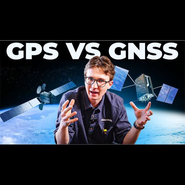
In today’s world, navigation technology plays an essential role in our daily lives. Whether we’re driving to work, finding the fastest route to our favorite coffee shop, or navigating an unfamiliar location, most of us rely on what we commonly call GPS (Global Positioning System). However, what many people don’t realize is that GPS is just one part of a much larger system known as GNSS (Global Navigation Satellite System). Understanding the difference between the two can help us better grasp how our devices work and why we should update our terminology to reflect modern technology. You will see a huge difference in performance between a GPS only receiver and a multi-constellation GNSS receiver!
How Navigation Satellites Work
Why Multiple Navigation Constellations Matter
Trilateration And Why You Want More Satellites
Achieving Centimeter-Level Accuracy with RTK
Practical Applications of GNSS Technology
The Role of GNSS in Timekeeping
Future Developments in GNSS Technology
GPS (Global Positioning System) has been around for roughly 50–60 years, but it has only been widely accessible for everyday use over the past 20 years or so (We wrote an article on the history of GPS, check it out: GPS in Surveying – From Weapon of War to Everyday Tool). Today, it’s hard to imagine a world without GPS. From tracking Amazon packages to getting real-time traffic updates, GPS technology has transformed the way we live. Without GPS and GNSS, modern transportation, logistics, and even emergency response systems would be significantly impaired.
But what exactly is GPS? And how does it differ from GNSS? To answer these questions, we first need to understand how navigation satellites work.
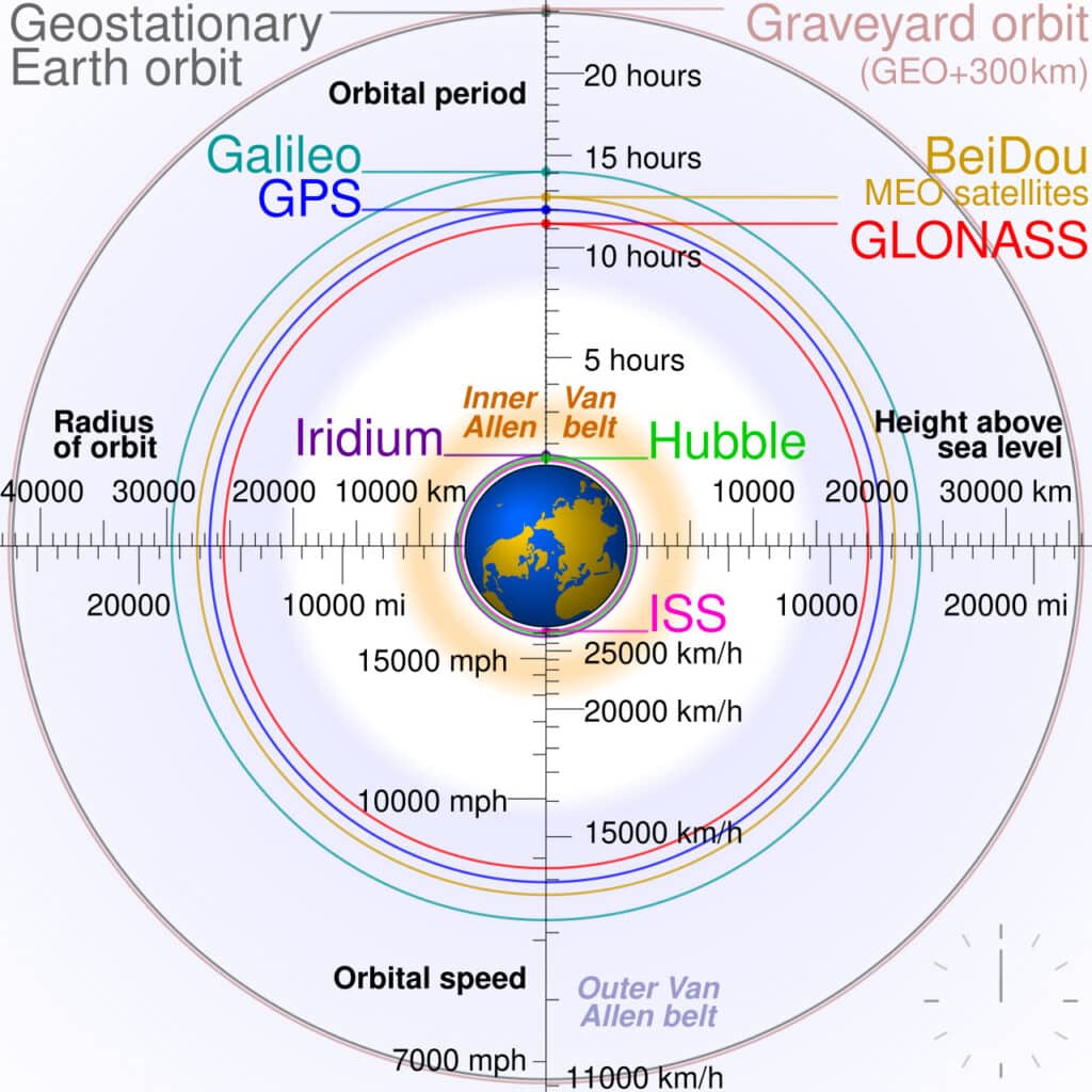
Navigation satellites orbit the Earth around 20,000 kilometers above the surface of the Earth and are travelling at speeds of ~7,000 km/h, completing an orbit of the Earth every ~12 hours. Despite their rapid movement, they are able to provide highly accurate timing and positioning data to the Earth’s surface, broadcasting the information over radio waves.
On a very simple level, each satellite transmits two key pieces of information:
By receiving signals from multiple satellites, a GPS receiver can calculate its own position on Earth using a process called trilateration—which we’ll discuss in more detail later. For a more detailed look at what information these signals carry and what your receiver needs, check out my video: What is RTK and How Does it Work?
GPS, or the Global Positioning System, was the original satellite-based navigation system. Developed by the U.S. Department of Defense, GPS consists of a constellation of 24 to 32 satellites orbiting the Earth, providing global coverage for positioning and navigation.
However, GPS is just one of many satellite navigation systems. Relying solely on one country’s system poses risks, including potential political and operational vulnerabilities. To address these concerns, other countries have developed their own independent navigation systems, which collectively make up GNSS.

GNSS stands for Global Navigation Satellite System, which includes multiple satellite constellations from different countries. Unlike GPS, which is a single system operated by the U.S., GNSS encompasses multiple global and regional navigation systems, including:
Paired with GPS, these are the major global systems, but there are also several regional systems.
It is the combination of these navigation systems that make up the GNSS umbrella, rather than with GPS which is a component of GNSS.
When comparing GNSS vs GPS, the core distinction is scope. GPS is a single satellite navigation system, one constellation of satellites, operated by the United States government. GNSS is the collective term for all satellite navigation systems combined, of which GPS is just one member.
In practical terms, a GPS-only receiver can only access satellites from the American constellation. A GNSS receiver, by contrast, can access signals from GPS, GLONASS, Galileo, BeiDou, and regional systems like QZSS, giving it a much larger pool of satellites to work with at any given moment.
Why does that matter? More satellites means more redundancy, faster fix times, and better performance in difficult environments like dense forests, urban corridors, and areas with obstructed sky views. A GPS-only receiver may struggle to maintain a reliable fix where a multi-constellation GNSS receiver holds steady.
For professional applications in surveying, construction, and mapping, this difference is significant. Modern 7th generation GNSS receivers like the Hemisphere S631 are built to take advantage of every available constellation and signal, an advantage that a GPS-only device simply cannot offer. The bottom line in the GNSS vs GPS debate: GPS is a subset of GNSS, and for serious positioning work, more constellations always means better results.
Using multiple navigation systems increases the likelihood of obtaining accurate positioning, especially in environments where signals may be obstructed or reflected by multi-path. For instance, if a building or tree blocks the signal from one satellite, a receiver can rely on signals from another constellation. This redundancy is particularly useful in urban environments and remote locations.
If you have ever tried to navigate with your phone under trees, you have probably noticed that the position on your screen is displayed by a very large circle, making it difficult to determine where you are. This is because as signals are reflected as they reach your device, the positional certainty becomes worse and worse. I actually did a video where I compared an iPhone to RTK to demonstrate why having more constellations and signals is so important.
To actually determine an accurate position, a GNSS receiver needs signals from at least three to five satellites. The process, known as trilateration, works as follows:

By having the ability to use more than 1 constellation you can calculate a position off any constellation. This decreases the time to obtain a solution, as you can use the best possible data to calculate your position.
For professional applications like land surveying, construction, and precision agriculture, accuracy down to the centimeter is crucial. This level of accuracy is achieved using Real-Time Kinematic (RTK) positioning, which involves:
This technology has revolutionized industries that rely on precise positioning, allowing surveyors to replace traditional optical equipment with GNSS-based solutions. You can check out the above mentioned RTK video, or my video on repeatability:
Beyond everyday navigation, GNSS technology has a wide range of applications:
One lesser-known but crucial use of GNSS technology is in time synchronization. Many critical infrastructure systems, including financial markets, telecommunications, and data centers, rely on GNSS timing to ensure synchronized operations.
Despite its widespread adoption, GNSS technology continues to evolve. Some key advancements on the horizon include:
Expansion Beyond Earth – With the potential colonization of the Moon and Mars, there is ongoing research into implementing GNSS-like systems for extraterrestrial navigation.
GPS has become a household term, but the reality is that modern navigation technology relies on GNSS—a combination of multiple satellite systems working together to provide more reliable and accurate positioning. While GPS remains an integral part of this system, understanding the broader scope of GNSS can help us appreciate the technological advancements that make precise navigation possible.
As GNSS technology continues to improve, we can expect even more precise, reliable, and innovative applications, shaping the future of navigation both on Earth and beyond. Whether you’re a surveyor, a driver, or simply someone who relies on navigation apps, embracing the term GNSS can help us better describe the sophisticated technology that guides us every day.
GPS (Global Positioning System) is a satellite navigation system operated by the U.S., while GNSS (Global Navigation Satellite System) is an umbrella term that includes multiple satellite systems from different countries, such as GLONASS (Russia), Galileo (EU), and BeiDou (China), providing more accuracy and reliability.
GNSS receivers can access signals from multiple satellite constellations, increasing the number of satellites available for trilateration. This improves positioning accuracy, especially in obstructed environments like urban areas or forests.
Trilateration calculates a position by measuring distances from at least three satellites. Additional satellites refine accuracy by reducing uncertainty, allowing precise location determination.
GNSS is used in land surveying, agriculture, autonomous vehicles, emergency services, maritime navigation, and infrastructure management, providing precise positioning for various applications.
Future developments include higher accuracy signals (such as Galileo’s High Accuracy Service), improved performance in obstructed areas, and potential expansion of GNSS technology for extraterrestrial navigation on the Moon and Mars.
A GPS antenna receives signals only from U.S. GPS satellites. A GNSS antenna is built to receive signals across multiple frequency bands from all major constellations: GPS, GLONASS, Galileo, and BeiDou. For professional surveying and mapping, a multi-band GNSS antenna is essential to get the most out of your receiver.
GPS signals refer specifically to frequencies broadcast by the American GPS constellation: L1, L2, and L5. GNSS signals is the broader term covering all frequencies from all constellations. Modern multi-frequency GNSS receivers track far more signals simultaneously, which is why they outperform GPS-only units in challenging environments.
A GPS receiver only processes signals from the American GPS constellation. A GNSS receiver tracks signals from multiple constellations at once: GPS, GLONASS, Galileo, BeiDou, and regional systems. For professional applications in surveying or construction, a multi-constellation GNSS receiver delivers faster fixes, better accuracy, and stronger reliability in the field.
GNSS is the clear winner because it includes GPS, GLONASS, and every other constellation combined. Between GPS and GLONASS as standalone systems, GPS offers stronger overall global performance for civilian use, while GLONASS adds useful redundancy, particularly at higher latitudes. For any serious positioning work, a receiver using all constellations together will always outperform any single system on its own.
Bench Mark Equipment & Supplies is your team to trust with all your surveying equipment. We have been providing high-quality surveying equipment to land surveyors, engineers, construction, airborne and resource professionals since 2002. This helps establish ourselves as the go-to team in Calgary, Canada, and the USA. Plus, we provide a wide selection of equipment, including global navigation satellite systems, RTK GPS equipment, GNSS receivers, and more. We strive to provide the highest level of customer care and service for everyone. To speak to one of our team today, call us at 403-286-0333 or email us at [email protected].
