Home > MicroSurvey
The Bench Mark advantage
MicroSurvey is one of the top developers of survey software in the world. With some of the fastest, most intuitive, and easy-to-use software packages, it’s no wonder the MicroSurvey FieldGenius software is a bestseller at Bench Mark and worldwide. MicroSurvey continues to support their software packages with continual updates, new innovations and ground breaking features all to provide you with the a cutting edge experience that keeps you in front of the competition. With software packages for land surveyors, civil engineers, seismic surveyors, mapping professionals and more, MicroSurvey has an answer for all of your software needs. Talk to a member of our team today to find out exactly what solution will work best for your needs.
MicroSurvey stands out for its:
Professional surveyors commonly use dedicated field data collection software, survey-focused CAD platforms, and network adjustment tools. MicroSurvey provides this complete workflow through FieldGenius for field data capture, MicroSurvey CAD for drafting and calculations, and STAR*NET for precise least-squares adjustment.
Yes. MicroSurvey software is designed to work with a wide range of GNSS receivers, robotic total stations, and conventional survey instruments. This compatibility allows survey crews to integrate existing hardware into a consistent field-to-office workflow.
MicroSurvey CAD includes surveying-specific drafting, calculations, and coordinate geometry tools that many surveyors require for daily work. While AutoCAD may still be used in some engineering environments, MicroSurvey CAD is purpose-built for surveying tasks and often reduces the need for additional CAD software.
FieldGenius is designed specifically for field use, providing intuitive data collection, stakeout routines, and real-time coordinate management. It supports GNSS and total station workflows and is optimized for efficient operation in real survey conditions.
STAR*NET is widely used for least-squares network adjustment, error analysis, and survey control verification. It helps ensure measurement consistency and provides confidence in final coordinate accuracy for engineering and legal survey work.
Standard packages typically include core surveying functionality required for everyday work, while higher-tier versions add advanced tools, automation, and expanded processing capabilities. Software can usually be upgraded as project requirements grow.
MicroSurvey software is designed with intuitive workflows and clear interfaces to reduce training time. Learning resources, tutorials, and practical guidance help new users become productive quickly in both field and office environments.
Selection depends on whether you need field data collection, CAD drafting, network adjustment, or a complete workflow. Many professionals combine FieldGenius, MicroSurvey CAD, and STAR*NET to create an efficient end-to-end surveying solution.
Save Time and Money
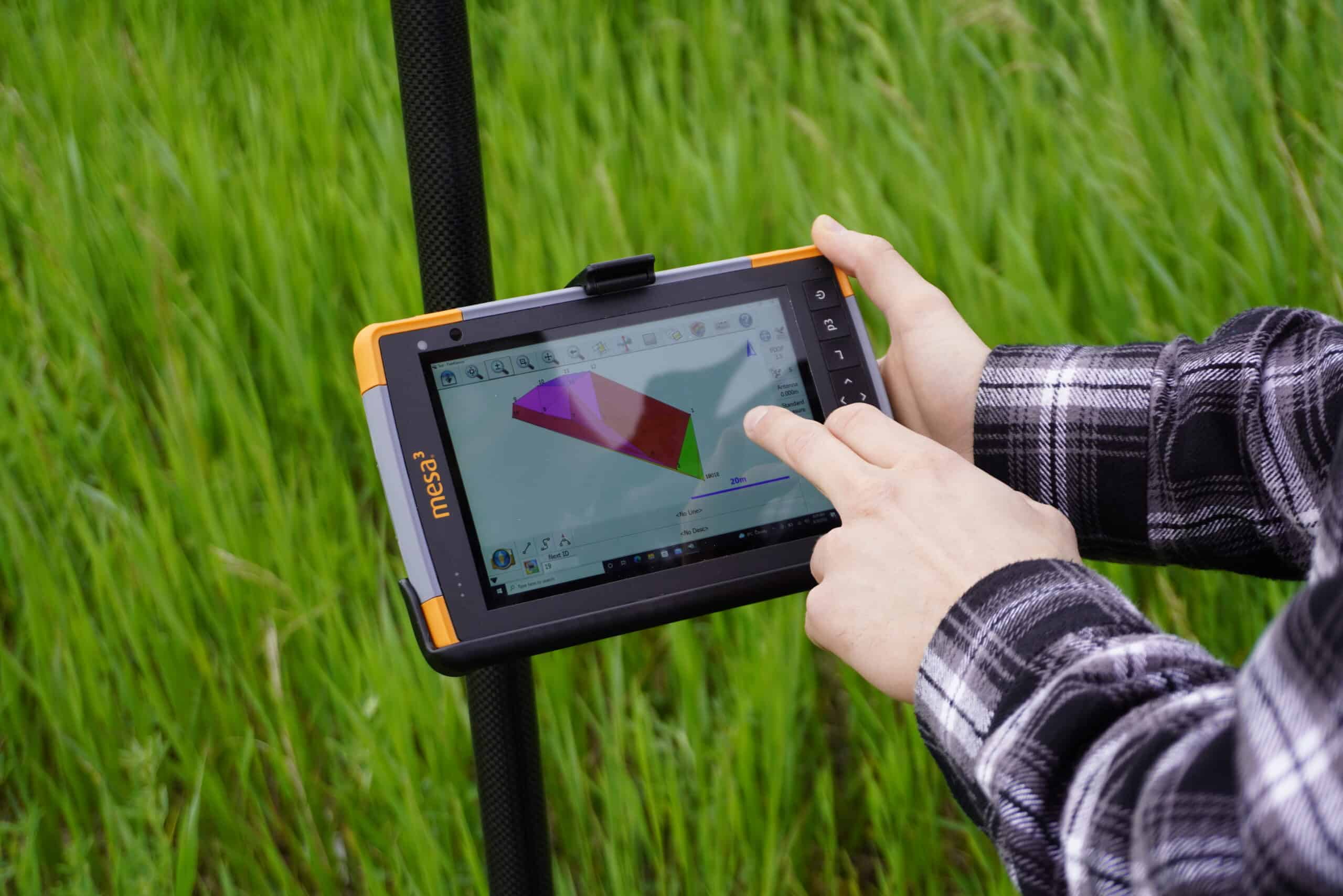
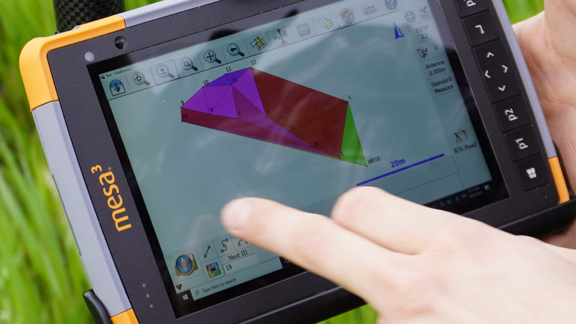
MicroSurvey’s flagship field software product is FieldGenius. With easy one touch functionality, you can quickly perform code free linework. There is no need to learn complex menus, everything is available from the map screen. This is the easiest to use and most complete survey software solution on the market. FieldGenius presents users with an incredibly friendly interface, and so far, everyone who has tried it out has stuck with it. In terms of productivity, there is no close second to FieldGenius’s efficiency and intelligence. So whether you need to stake out points, lay a grid or determine a slope, MicroSurvey’s FieldGenius is the answer for you.
MicroSurvey software is packed with features designed to simplify workflows and increase efficiency.
Feature / Criteria | MicroSurvey (FieldGenius / MSCAD / STAR*NET) | Trimble Business Center | Carlson Survey | Leica Captivate / Infinity |
Ease of Use | Highly intuitive interface, especially with MicroSurvey FieldGenius | Powerful but can have a steeper learning curve | Familiar for AutoCAD users but can be complex | Advanced but often requires training |
Field Software | Strong field solution with FieldGenius software, including Android support | Typically paired with Trimble hardware ecosystem | Field solutions available but less streamlined | Tight integration with Leica hardware |
Workflow Integration | Seamless field-to-office workflow across MicroSurvey products | Strong integration within Trimble ecosystem | Good integration with Carlson CAD | Strong but tied to Leica systems |
Platform Flexibility | Supports multiple devices, including MicroSurvey FieldGenius for Android | Often optimized for Trimble devices | Works within AutoCAD environment | Primarily Leica-focused platforms |
Cost / Value | Cost-effective solution with strong performance | Premium pricing | Mid-range pricing | Premium pricing |
Best For | Surveyors seeking efficient, user-friendly, and flexible software | Large firms using full Trimble ecosystems | Users familiar with AutoCAD workflows | High-end Leica equipment users |
From field data collection to accurate final deliverables
MicroSurvey software connects field data collection with office processing in a single, efficient workflow. FieldGenius enables fast and accurate data capture using GNSS receivers and total stations, simplifying staking, measurements, and linework in the field.
Collected data transfers directly into MicroSurvey CAD (MSCAD), where it’s processed, drafted, and prepared for deliverables without unnecessary conversion or delays. For projects requiring higher precision, STAR*NET provides network adjustment and validation to ensure reliable results.
This integrated workflow supports surveying, construction layout, engineering, and mapping applications, helping teams reduce errors, improve efficiency, and maintain consistent accuracy from field to finish.
Find out About the BenchMark Advantage
For over 18 years, we’ve supported surveying professionals across North America with practical expertise and reliable technical support. Our team has real field experience with the equipment and software we provide, so we understand the challenges you face on site and in the office.
We focus on helping you get the most out of your MicroSurvey software by ensuring everything works the way you need it to. From initial setup to ongoing support, we’re here to keep your workflow running smoothly.
We assist with software configuration, provide tailored training, and offer responsive technical support for troubleshooting, updates, and optimization. The goal is simple: help you work more efficiently and get consistent, reliable results from your surveying workflow.