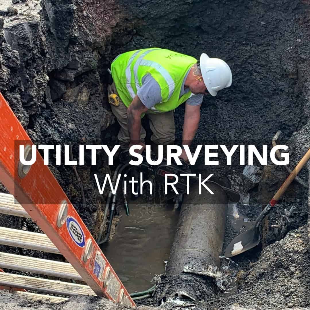
Utility mapping isn’t what it used to be. Accuracy is no longer optional because mistakes in the field lead to damaged assets, safety risks, and costly delays. That’s why more engineers, surveyors, and construction pros across Canada and the U.S. are turning to modern RTK solutions.
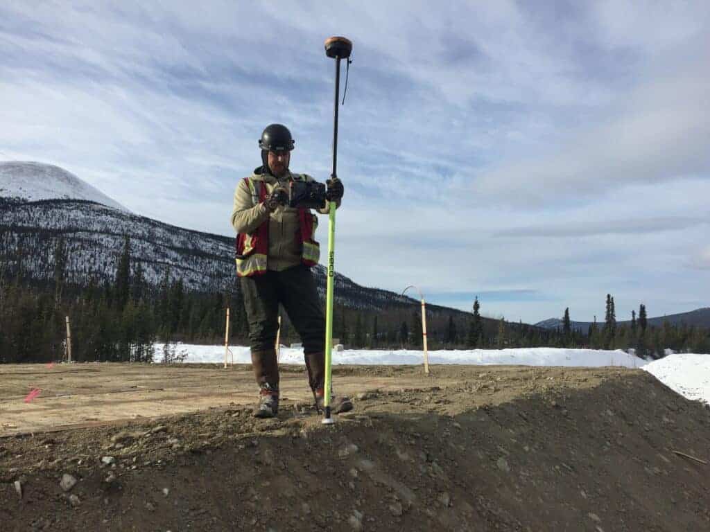
RTK GPS systems with next-gen GNSS receivers are especially valued. It opens opportunities to faster, safer, and more precise utility surveys.
Why Accuracy Matters in Utility Mapping
How RTK Solutions Improve Underground Detection
Faster Surveys, Fewer Delays
Built for the Field
Frequently Asked Questions
Centimetre-level accuracy is crucial when you have to deal with underground gas lines, fiber optic cables, or water mains. Traditional mapping tools or single-frequency GPS systems don’t cut it and often miss or misplace utilities by critical margins.
In contrast, modern RTK GPS systems provide real-time corrections so that every shot you take is accurate. That means that even under canopy or around obstructions there is almost no risk of inaccurate utility locations. It minimizes the need for rework caused by equipment limitations.
Today’s seventh-generation GNSS receivers support full multi-frequency tracking across all active constellations: GPS, GLONASS, Galileo, and BeiDou. These systems also possess real-time corrections and tilt compensation. That is what powers them to provide highly reliable positional data, even in challenging conditions like:
Our flagship Hemisphere S631 RTK GPS system is designed for exactly these situations. It maintains tilt compensation and is compatible with industry-leading utility mapping software. The S631 makes sub-surface detection faster, easier, and more dependable.
One of the biggest benefits of switching to a modern RTK system is speed. Utility mapping with outdated or single-frequency gear often requires more time on-site. There appears a need for redundant measurements, or even supplementary total station work.
Upgrading to a high-efficiency RTK solution like the S631 can cut field time by 30-50%. It depends on the project, but in most cases you are guaranteed faster fix times, better performance under canopy, and less troubleshooting in the field. All these benefits contribute to more deliverables in less time.
Many utility surveys happen in rough conditions such as rural sites, active construction zones, or environments with limited infrastructure. That’s why rugged design and ease of use matter. Our systems are built for field performance:
We build open, flexible systems that prioritize your productivity. We don’t aim to upsell you on locked ecosystems, and just want to show you how TK can improve your next utility mapping project. Explore our full line of RTK GPS Systems and GNSS Receivers to find out how!
Not all GPS is created equal. Standard GPS, the kind built into consumer devices or older single-frequency receivers, typically delivers accuracy somewhere between 3 and 10 metres. That’s workable for navigation, but it’s not a foundation you can build a utility survey on. Misplacing an underground asset by even half a metre can mean a strike during excavation, a project shutdown, or worse.
RTK mapping addresses this directly. By applying live corrections from a base station or correction network, RTK receivers bring positional accuracy down to the centimetre level. In practice, the gap between the two approaches is substantial:
For utility mapping, the positional stakes are too high to rely on uncorrected GPS. RTK isn’t an upgrade, it’s the starting point.
Selecting the right RTK equipment for utility mapping comes down to three things: accuracy under real field conditions, reliability in obstructed environments, and clean integration with the software and locating tools you’re already using.
These are the capabilities that matter most:
The Hemisphere S631 is built around all of these requirements and has become a trusted choice for utility mapping teams across North America. If you’re weighing your options, our team is glad to help match the right receiver to your project conditions.
RTK (Real-Time Kinematic) is a satellite correction technology that improves GPS accuracy to the centimetre level. This means more precise asset location with less risk of striking unknown lines during excavation during underground utility mapping.
Yes. Modern RTK systems like the Hemisphere S631 use multiple GNSS constellations and advanced filtering to maintain a reliable fix in different environments.
RTK cannot replace GPR, but it complements GPR or EM locators well. It provides the positional accuracy needed to georeference utility data from those tools.
Depending on your current workflow, you can reduce field time by 30-50% using modern RTK gear.
Older-generation RTK receivers may offer limited accuracy, slower fix times, and reduced performance in obstructed environments. That’s why you may consider upgrading to improve your deliverables.
RTK mapping is the practice of collecting geospatial data using a Real-Time Kinematic GPS receiver. Where standard GPS relies on satellite signals alone, RTK systems apply live positional corrections to achieve centimetre-level accuracy. You get the data accurate enough to support safe excavation, reliable design, and defensible infrastructure records.
It depends on how the data will be used. For general reconnaissance or preliminary land mapping, standard GPS may be adequate. For utility mapping, infrastructure surveys, or any work where a positional error carries safety or legal consequences, RTK is effectively the minimum standard. That’s because uncorrected GPS is too significant to accept when underground assets are involved.
