A subdivision gets built on the wrong lot. A highway alignment drifts two metres off centerline. A boundary dispute ends up in court. These are real consequences of survey work carried out without a solid control network. Before a total station is set up, before a rover leaves the truck, the accuracy of your entire project has already been decided by something most people never see: your control points.
What Are Control Points in Surveying?
Types of Control Points in Surveying
Why Control Points Matter for Accuracy
How to Establish Control Points in Surveying
Precision Is Built Before the First Shot Is Taken
Control points are fixed, precisely measured reference locations whose geographic coordinates, typically expressed as northing, easting, and elevation, are known to a high degree of accuracy. Every measurement taken across a project ties back to these points. They are the spatial backbone of any survey, the anchors that keep your data aligned with the real world rather than drifting into its own internal universe.
In Canadian surveying practice, control points are commonly referenced to the North American Datum of 1983 (NAD83) for horizontal position and the Canadian Geodetic Vertical Datum of 2013 (CGVD2013) for elevation. These national frameworks ensure that survey data integrates cleanly across projects, jurisdictions, and software platforms.
Control points fall into two primary categories:
Some points serve both functions simultaneously, providing a full three-dimensional reference that modern GNSS equipment can establish in a single observation session.
Not all control points are the same, and understanding their hierarchy matters when planning a project.
Primary control forms the highest-order network. In Canada, these are typically federal monuments maintained by Natural Resources Canada (NRCan) through the Canadian Spatial Reference System (CSRS). They are established with the highest precision instrumentation and serve as the root reference for everything beneath them.
Secondary control is derived from primary monuments and used to densify the network across a project area. Municipalities, provincial agencies, and engineering firms often establish secondary control as part of infrastructure projects. These points are permanent, well-monumented, and published for professional use.
Local or project control is established by surveyors specifically for a given job. These points may be temporary or permanent depending on the scope of work. A subdivision layout, for example, might require a local control network that references secondary monuments and then gets used repeatedly across multiple construction phases.
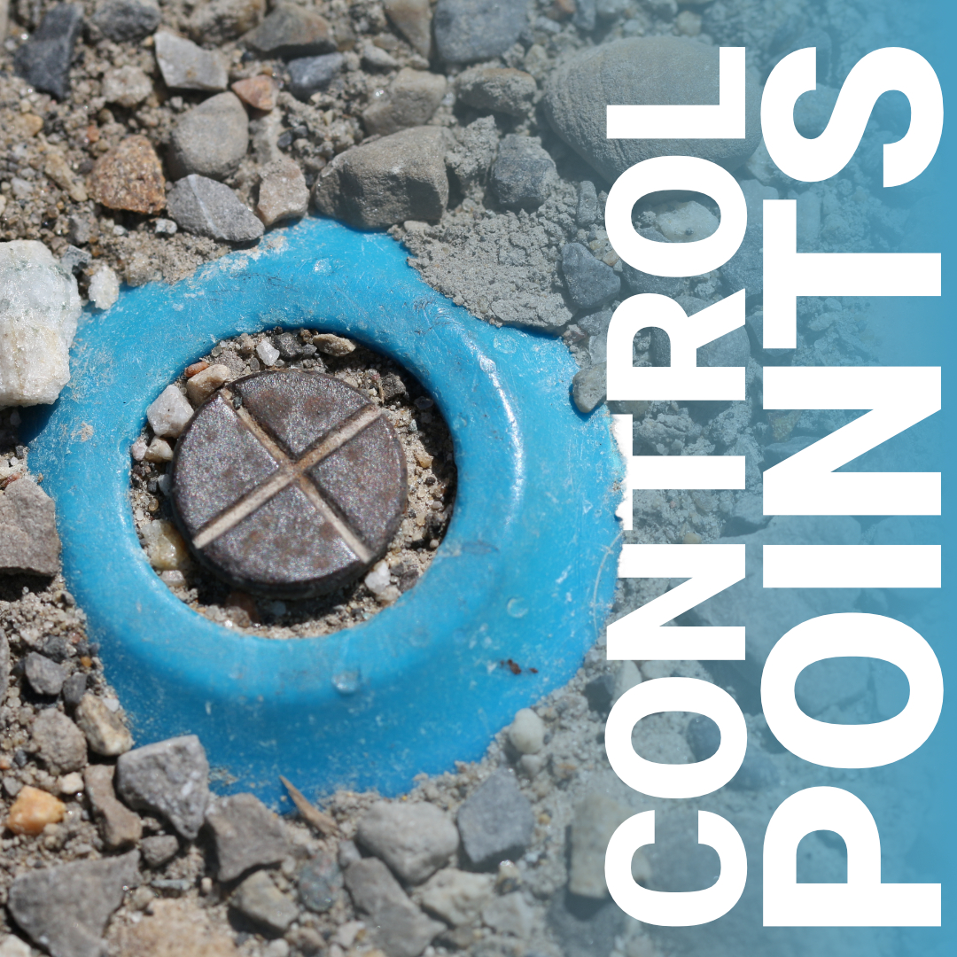
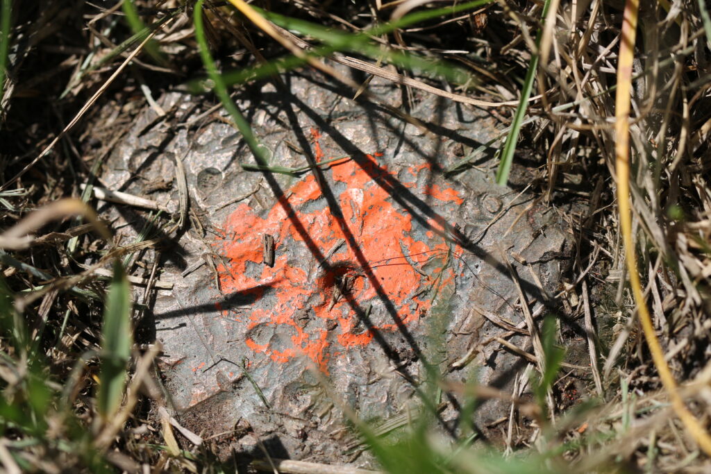
Benchmarks are a vertical-specific subset. You’ll find these embedded in concrete structures, bridge abutments, or dedicated monuments, and they carry known elevations used for grade control and earthworks.
Measurement error is cumulative. The further you work from your last known position, the more small errors compound into large ones. Control points interrupt that process by giving surveyors fixed positions to tie into, check against, and restart from.
On large sites, the kind common in Canadian land development, whether it’s a new residential community north of Calgary or a road corridor through the Shield, this is especially critical. A project spanning several kilometres cannot rely on a single setup. Control networks distribute the accuracy burden across the site, so no single measurement chain carries the entire load.
Beyond internal accuracy, control points make your data usable by others. When a civil engineer opens your survey file, they need to know that your coordinates match theirs. When a municipality reviews your plan, it needs to integrate with their GIS. When a contractor stakes the foundation, it needs to align with the architect’s drawings. Shared, well-documented control makes all of that possible without conversion headaches or alignment guesswork.
Control points also provide a mechanism for quality assurance. By measuring to a known point and comparing the result to its published coordinates, surveyors can verify that their equipment is performing correctly and that no systematic error has crept into their data.
Setting up a reliable control network is a deliberate process. It is not something done quickly at the start of a job and forgotten. Here is how it typically unfolds in professional practice:
Research existing control first. Before placing any new monuments, a competent surveyor checks NRCan’s geodetic database and municipal records for existing control in the area. Using published monuments keeps your project tied to the national framework and avoids unnecessary duplication.
Select stable, accessible locations. Control points need to survive the duration of the project. That means avoiding areas prone to frost heave, construction disturbance, or vehicle traffic. In Canada, frost depth varies significantly by region, so monuments often need to be set below the frost line to remain stable year-round.
Monumentation must be durable. Concrete monuments, iron pins, and survey nails in asphalt are common choices. The physical marker should be recoverable, protected where possible, and described clearly in field notes so the next surveyor can find it without issue.
Measure with appropriate precision. Modern RTK GNSS equipment like the Hemisphere S631 can establish control points efficiently in the field, particularly when working from a network RTK correction source or a local base station. For the highest-order work, static GNSS observations or total station traverses tied to primary monuments are still the standard. The method depends on the accuracy requirements of the project.
Verify and close. A control network should always be checked by closing back on a known point. The difference between your measured position and the published coordinates, the misclosure, tells you how well your network performed. Acceptable misclosure limits vary by survey type and jurisdiction, but no professional should leave the field without closing their traverse.
Document everything. Each control point should be recorded with its coordinates, a written description of the monument location, a sketch or photo, and the equipment and methods used to establish it. This documentation protects you and serves every professional who follows you on the project.
There is a tendency to think of control points as setup work, something you get through before the real surveying begins. That framing has it backwards. The control network is the survey. Everything else is detail work built on the foundation you establish in those first hours on site.
When control is done right, field crews work faster, data integrates cleanly, and projects close without surprises. When it is done poorly, errors surface at the worst possible moments: during construction, during plan review, or during a dispute that lands in front of a land surveyor or the courts.
At Bench-Mark, we supply the equipment that professional surveyors across Canada rely on to establish and verify control, from the Hemisphere S631 RTK system to the software that ties it all together. If you have questions about the right setup for your control network, our team works directly with surveyors in the field and can help you match the right tools to the job.
