
Surveying for road construction is one of those disciplines where small errors turn into very expensive problems. A few centimeters off in alignment, elevation, or control can result in drainage failures, premature pavement wear, or rework that slows an entire project.
Road construction surveying provides the foundation every downstream decision depends on. Let’s break down how road surveys are actually performed, what accuracy is expected at each stage, and which surveying equipment makes the most sense for modern Canadian road work.
Why Surveying Matters in Road Construction
Core Surveying Methods Used in Road Projects
Accuracy Requirements: What’s Actually Expected
Equipment That Makes Sense for Road Construction Surveys
Why RTK GNSS Is Central to Modern Road Surveys
Recommended Equipment for Canadian Road Construction
Software Integration Matters More Than Specs
Common Challenges in Road Construction Surveying
Building Roads on a Solid Survey Foundation
Roads don’t exist in isolation. They interact with terrain, utilities, drainage systems, property boundaries, and environmental constraints. Surveying for road construction ties all of that together into a single reality that designers and contractors can rely on.
A road survey answers a few critical questions:
In Canada, these questions often come with extra complexity. Seasonal ground movement, frost heave, forested corridors, and remote project locations all increase the demand for reliable positioning and repeatable accuracy. That’s why survey methods and equipment choice matter as much as field technique.
Road construction surveys evolve alongside the project. Each phase relies on slightly different methods, but they all share the same goal: consistent data.
Route reconnaissance and preliminary surveys establish feasibility. These early surveys define the general corridor, identify constraints, and provide baseline topography for design. Speed and coverage matter here, but accuracy still needs to be sufficient for engineering decisions.
Control surveys form the basis of the project. Permanent or semi-permanent control points are established along the alignment so every crew, machine, and measurement references the same coordinate system. In large Canadian projects, this control network often spans kilometers and must remain stable through multiple seasons.
Construction layout and staking translates design into reality. Centerlines, offsets, grades, and structures are set out so crews can build exactly what was engineered. This is where real-time positioning and fast fixes become critical to keep schedules moving.
As-built surveys confirm what was actually constructed, verify compliance, and provide documentation for handover, maintenance, and future upgrades.
Accuracy expectations change depending on the task, but road construction consistently demands more than close enough. Horizontal and vertical tolerances directly affect ride quality, drainage, and long-term performance. For most road construction work, surveyors are expected to maintain:
In practice, this means relying heavily on RTK GNSS for open areas and combining it with total stations in constrained environments. Canadian projects often require this hybrid approach due to tree cover, urban interference, or steep terrain.
Thus, a system that delivers the same result every time, regardless of weather or site conditions, is far more valuable than one that’s theoretically precise but unstable in the field.
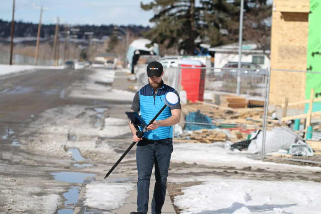
Modern surveying for road construction blends established instruments with advanced positioning technology. The goal is efficiency without sacrificing reliability. Here’s how the core tools fit into road work workflows:
For many road construction teams, RTK GNSS has become the primary positioning tool, because other instruments support edge cases rather than driving the workflow.
Instead of relying solely on line-of-sight measurements, surveyors can now position points in real time across long distances with centimeter-level accuracy. For road projects, this brings several practical advantages:
RTK also supports flexible workflows, from early grading through final paving.
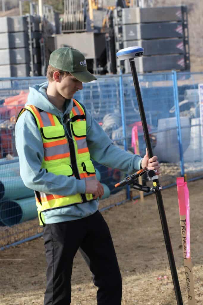
Not all GNSS systems perform equally in real-world conditions. Road construction demands receivers that can handle long baselines, partial sky visibility, and temperature extremes without constant troubleshooting.
Survey-grade systems like the Hemisphere S631 have become one of the best choices for many Canadian road projects due to the offered accuracy, reliability, and value. They possess full multi-constellation support and strong RTK performance. That’s why they’re well suited to corridor work, subdivision development, and large-scale construction sites.
Hardware alone doesn’t deliver accuracy. Surveying for road construction depends heavily on how well your equipment integrates with your software environment.
Field software like FieldGenius allows surveyors to move between GNSS and total station workflows, apply correct coordinate systems, and provide data consistency across the project lifecycle. In road construction, where multiple crews and stakeholders interact with the same dataset, this integration reduces errors and rework.
Even with the right tools, road surveys come with predictable challenges:
The solution is a balanced approach that combines RTK GNSS efficiency with traditional precision where needed, supported by software that keeps everything aligned.
Surveying for road construction is ultimately about trust. Engineers trust the data to design safely. Contractors trust the layout to build efficiently. Owners trust the final product to perform for decades.
In the Canadian context, that trust depends on reliable RTK workflows, well-established control, and equipment that performs consistently across diverse environments. When your survey foundation is solid, everything downstream moves faster, costs less, and lasts longer.At Bench-Mark, we work with surveyors, engineers, and construction teams across Canada and the US to configure road construction survey setups that actually work in the field. Not just in ideal conditions, but on real sites with real constraints. Because when it comes to road construction, accuracy is the starting line.
