
The Global Positioning System (GPS) is a satellite-based technology that has become a part of everyday life, whether you realize it or not. From the navigation apps on our phones to tracking systems in transportation, agriculture, and geospatial mapping, GPS has transformed the way we interact with the world. However, GPS wasn’t always a civilian tool—it was initially developed to fight the Soviets during the Cold War. The story of how it transitioned from military use to becoming essential in civilian industries is one of technological innovation, political shifts, and increasing demand for precision.
In this article, we’ll dive into how GPS changed land surveying. Surveying, which once involved time-consuming manual methods, has been completely transformed by GPS technology, allowing surveyors to work more accurately and efficiently than ever before. Today, the use of GPS in surveying has become standard practice across the geospatial industry, enabling professionals to collect precise positioning data in environments where traditional methods once struggled. We’ll explore how GPS evolved, focusing on key developments like Real-Time Kinematic (RTK) GPS and the newer GPS III satellites, which have significantly enhanced surveying capabilities.
Origins of GPS: A Military Invention
Unlocking Full Accuracy: The End of Selective Availability
Real-Time Kinematic (RTK) GPS: Precision in Real Time
The Role of Multi-Frequency RTK Systems
GPS III and the Future of Surveying
Multi-GNSS Integration: A Global Approach
The Future of GPS in Surveying
Cold War Beginnings
GPS has its roots in the Cold War, a time when the U.S. Department of Defense was looking for better navigation tools for its military. Early systems like LORAN and Transit gave the military some navigational capabilities, but they weren’t precise or reliable enough, especially for tasks involving weapons targeting. What the military needed was a global system that could provide accurate, real-time positioning no matter where they were in the world.
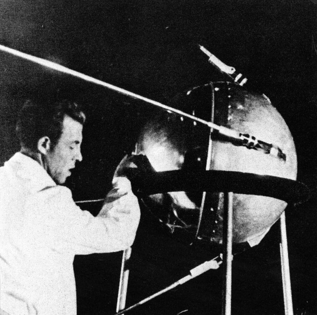
In the late 1950s, with the launch of Sputnik in 1957 we began to see how satellites were going to change the way we lived our lives. By analyzing the radio waves broadcast by Sputnik to verify the launch of the satellite, scientists took the first steps toward the development of GPS (The Early Days of Sputnik). As the idea for GPS began to take shape, the first experimental satellites were launched in the early 1970s. By 1978, the first operational GPS satellite was in orbit, and by the mid-1980s, the system was close to being fully functional, with 24 satellites providing global coverage. At this point, GPS was primarily intended for missile guidance and troop navigation, offering unparalleled accuracy to the U.S. military.
To maintain a strategic advantage over their adversaries (primarily the Soviet Union), the US military encrypted the signals, making them impossible for Civilian navigation. These signals would later evolve into the military GPS signals which require special decoder units to use.
The Turning Point: Korean Air Lines Flight 007
Civilian access to GPS was borne of tragedy. In 1983, a Korean Air Lines Flight 007 was mistakenly shot down by Soviet forces after it strayed into their airspace due to a navigational error (This great article covers it more in depth: A Shot in the Dark: The Untold Story of Korean Air Lines Flight 007). This tragic incident, which claimed the lives of 269 people, highlighted the limitations of traditional navigation systems.

In response, President Ronald Reagan made a landmark decision: once GPS was fully operational, it would be made available to civilians. This set the stage for GPS to expand beyond military use. However, this was not without any caveats. Civilians would not gain access to the military signals, but rather a degraded Selective Availability mode. still restricted the precision of civilian GPS, meaning its full potential wouldn’t be realized for another two decades.
In May 2000, a major breakthrough for civilian GPS occurred. President Bill Clinton announced the end of Selective Availability, giving civilian users access to the same level of accuracy that the military had enjoyed for years. With the flip of a switch, GPS accuracy for civilians improved dramatically—from around 100 meters to around 5 meters. This change had a huge impact across many industries, but for surveyors in particular, it opened up new possibilities for precision and efficiency.
Surveying Before GPS: The Traditional Methods
Before GPS, surveying was a labor-intensive process, often requiring crews with several people. Surveyors relied on tools like theodolites, tapes, and tapes to measure angles and distances. These methods required clear lines of sight between reference points and often involved large teams working long hours to establish property boundaries or create maps. Surveying was highly dependent on the environment—mountains, forests, and buildings could slow down the process or make it nearly impossible.
In the mid-20th century, Electronic Distance Measurement (EDM) technology came along, which made things a little easier. Total Stations used lasers to measure distances more quickly and accurately than manual methods. However, surveyors still faced the same environmental challenges and had to manually process their data.
How RTK Transformed Surveying
The real game-changer for surveyors came in the 1990s with the development of Real-Time Kinematic (RTK) GPS. RTK technology allows surveyors to achieve pinpoint precision (big difference between accuracy and precision!), down to the centimeter—in real time. This changed the way surveyors could conduct their field work and was a revolutionary leap forward for the profession. Surveyors could now get real time, accurate positions, with no need to traverse.
RTK works by measuring the phase of the GPS signal’s carrier wave. A typical RTK system consists of a base station and one or more rovers. The base station is set up at a fixed, known location and continually tracks satellite signals, comparing its actual position to the one calculated from the GPS data. It then identifies any errors in the GPS signals and sends these corrections to the rovers, which are mobile receivers that allow for the real time calculation of a position. With these corrections, the rovers can calculate their exact position to within a centimeter all while moving around.
This advancement was particularly impactful for construction and infrastructure projects, where surveyors needed to set precise points for roads, bridges, and buildings. RTK enabled them to work faster and more accurately, significantly reducing the potential for costly errors. These capabilities highlight why GPS in surveying has become indispensable for modern construction layout and infrastructure planning.
What makes RTK so important is its ability to deliver real-time results. In the past, surveyors who used GPS based instruments often had to spend days or even weeks post-processing data after collecting it in the field. With RTK, surveyors can collect accurate data on the spot, which means projects move faster and decisions can be made more quickly.
RTK GPS is also versatile. It doesn’t require a clear line of sight between fixed points like traditional surveying methods. Instead, as long as the rovers can communicate with the base station, they can gather precise data—even in rugged or densely forested areas. This makes RTK the go-to tool for modern surveyors, whether they’re working on urban infrastructure, rural land development, or remote environmental surveys. Areas of several square kilometers can easily be covered, with no need for the traverses between shots. What once took days or weeks can be done in an afternoon.
Modern RTK systems, like the Hemisphere S631 or Trimble R980 are even more advanced, thanks to the ability to receive signals from multiple different constellations and different signals. With the ability to use latest GPS signal bands, such as L1, L2, and L5 the latest receivers are more capable than ever before. These multiple frequencies allow the system to filter out errors caused by atmospheric disturbances, providing faster and more accurate positioning. The use of multiple frequencies makes RTK systems incredibly robust, ensuring reliable performance in even the most challenging environments. You can learn a little bit more about what goes into an RTK solution and the factors that influence your results here: Factors Affecting RTK Performance: An In-Depth Guide for Surveyors.

The Next Generation of GPS
While RTK revolutionized surveying, the introduction of GPS III satellites has further enhanced what surveyors can achieve in the field and in difficult environments. As the name suggests, GPS III is third iteration in GPS technology. The first iteration GPS I introduced selective availability (as well as a host of military signals), and was first launched in 1978. By 1989, GPS I began to be replaced by GPS Block II. Block II satellites went through multiple iterations introducing many civilian signals like L1, L2 and L5.
The latest iteration of GPS, Block III, began to be launched into orbit in 2018. These satellites offer stronger, more reliable signals and improved accuracy, especially in environments where satellite signals are typically weak or obstructed.
One of the most important features of GPS III is the new L1C signal, which is designed specifically for civilian use. The L1C signal is stronger and more reliable in challenging environments, like urban areas or dense forests, where traditional GPS signals might struggle to get through. For surveyors, this means better performance in areas that previously posed challenges. Whether they’re working in city centers with tall buildings or remote, forested locations, the L1C signal helps ensure that their measurements are more accurate and consistent.
Another important signal for surveyors is the L5 signal. It provides a third frequency that helps resolve errors caused by atmospheric interference, making RTK systems more reliable and faster to achieve accurate positioning, especially under trees.
Modern surveying encompasses a wide range of disciplines, and the role of gps in surveying continues to expand as positioning technologies improve. Surveyors across multiple industries rely on GPS-based tools to collect accurate spatial data efficiently and safely.
In land surveying, GPS is widely used for boundary surveys, topographic mapping, and property subdivision. High-precision RTK systems allow surveyors to establish control points and measure terrain quickly without requiring long sightlines between instruments.
Construction surveying also benefits significantly from GPS technology. Surveyors use RTK receivers to stake out infrastructure such as roads, bridges, pipelines, and building foundations with centimeter-level accuracy. This reduces layout errors and helps ensure projects follow engineering design specifications.
In environmental and geospatial surveying, GPS enables professionals to monitor land changes, map natural features, and collect spatial data across large or difficult-to-access areas. Wetlands mapping, forestry surveys, and environmental monitoring programs increasingly rely on GPS-enabled equipment to gather reliable data efficiently.
Together, these applications demonstrate how gps in surveying supports diverse industries, from construction and land development to environmental management and infrastructure planning.
In addition to the new GPS signals, modern surveying systems are increasingly taking advantage of other satellite constellations. By integrating signals from GLONASS (Russia), Galileo (Europe), and BeiDou (China), modern GNSS receivers can access more satellites than ever before. This is a significant improvement for surveyors, as it reduces the chances of signal dropouts and increases the overall reliability of the data they collect.
With today’s technology, surveyors in many parts of the world can access more than 30 satellites at any given time. This kind of coverage, combined with multi-frequency RTK capabilities, allows for unprecedented precision and reliability, even in environments that were once considered too challenging for accurate surveying. Even compared to last generation receivers, there has been a huge step forward in performance.
From its military origins to its role in everyday civilian life, GPS has profoundly changed the way surveyors work. The advent of RTK GPS technology and the launch of the GPS III satellite constellation have allowed surveyors to achieve new levels of accuracy, efficiency, and reliability. Today, surveyors can work faster, cover more ground, and produce more precise results than ever before.
As GPS technology continues to evolve and more GPS III satellites are launched, surveyors can look forward to even more improvements. The integration of additional GNSS constellations and the ongoing development of multi-frequency receivers will only enhance the capabilities of GPS-based surveying. With each new advancement, surveyors are better equipped to meet the demands of modern infrastructure, construction, and land management projects.
GPS was initially developed by the U.S. Department of Defense during the Cold War as a military tool to enhance navigation and missile guidance. The idea emerged in the 1960s, and the first operational GPS satellite was launched in 1978. GPS was designed to provide accurate, real-time positioning for military forces anywhere in the world, helping to guide weapons and navigate troops. Civilian access was not part of the original plan, and signals were encrypted to prevent adversaries from using them.
GPS became available to civilians after a significant event in 1983, when a Korean Air Lines flight was shot down by Soviet forces due to a navigation error. In response, President Ronald Reagan announced that GPS would be made available to civilians to prevent similar incidents in the future. However, civilian GPS was limited in accuracy by Selective Availability, a feature that degraded the signal for non-military users. Full accuracy became available in May 2000 when President Bill Clinton ended Selective Availability, allowing civilians to access GPS with an accuracy of around 5 meters.
GPS revolutionized land surveying by significantly improving the speed and accuracy of measurements. Before GPS, surveying was a labor-intensive process that relied on tools like theodolites and tapes to measure angles and distances, often requiring large teams and clear sightlines. With GPS, surveyors could cover large areas quickly, even in rugged or obstructed environments. The introduction of Real-Time Kinematic (RTK) GPS in the 1990s further advanced surveying by allowing surveyors to achieve centimeter-level precision in real time, reducing the need for post-processing and speeding up projects.
RTK GPS is a technology that allows surveyors to achieve highly accurate, real-time positioning, down to the centimeter. It works by using a base station at a fixed location to send correction data to mobile receivers (rovers) in the field, allowing them to calculate their precise positions almost instantaneously. RTK is crucial because it eliminates the need for lengthy post-processing of survey data, enabling surveyors to make faster decisions and complete projects more efficiently. It also works well in challenging environments where traditional methods struggle, such as urban areas or dense forests.
GPS III satellites, launched starting in 2018, provide several advancements over earlier GPS systems. One key feature is the new L1C signal, designed specifically for civilian use, which offers better performance in challenging environments like urban canyons or under dense tree canopies. Additionally, GPS III introduces the L5 signal, which improves the reliability and speed of Real-Time Kinematic (RTK) GPS by adding a third frequency that helps correct errors caused by atmospheric interference. GPS III satellites are also more powerful, offering stronger, more accurate signals, which makes them particularly beneficial for surveyors working in difficult conditions.
Bench Mark Equipment & Supplies is your team to trust with all your surveying equipment. We have been providing high-quality surveying equipment to land surveyors, engineers, construction, airborne and resource professionals since 2002. This helps establish ourselves as the go-to team in Calgary, Canada, and the USA. Plus, we provide a wide selection of equipment, including global navigation satellite systems, RTK GPS equipment, GNSS receivers, and more. We strive to provide the highest level of customer care and service for everyone. To speak to one of our team today, call us at 403-286-0333 or email us at [email protected].
